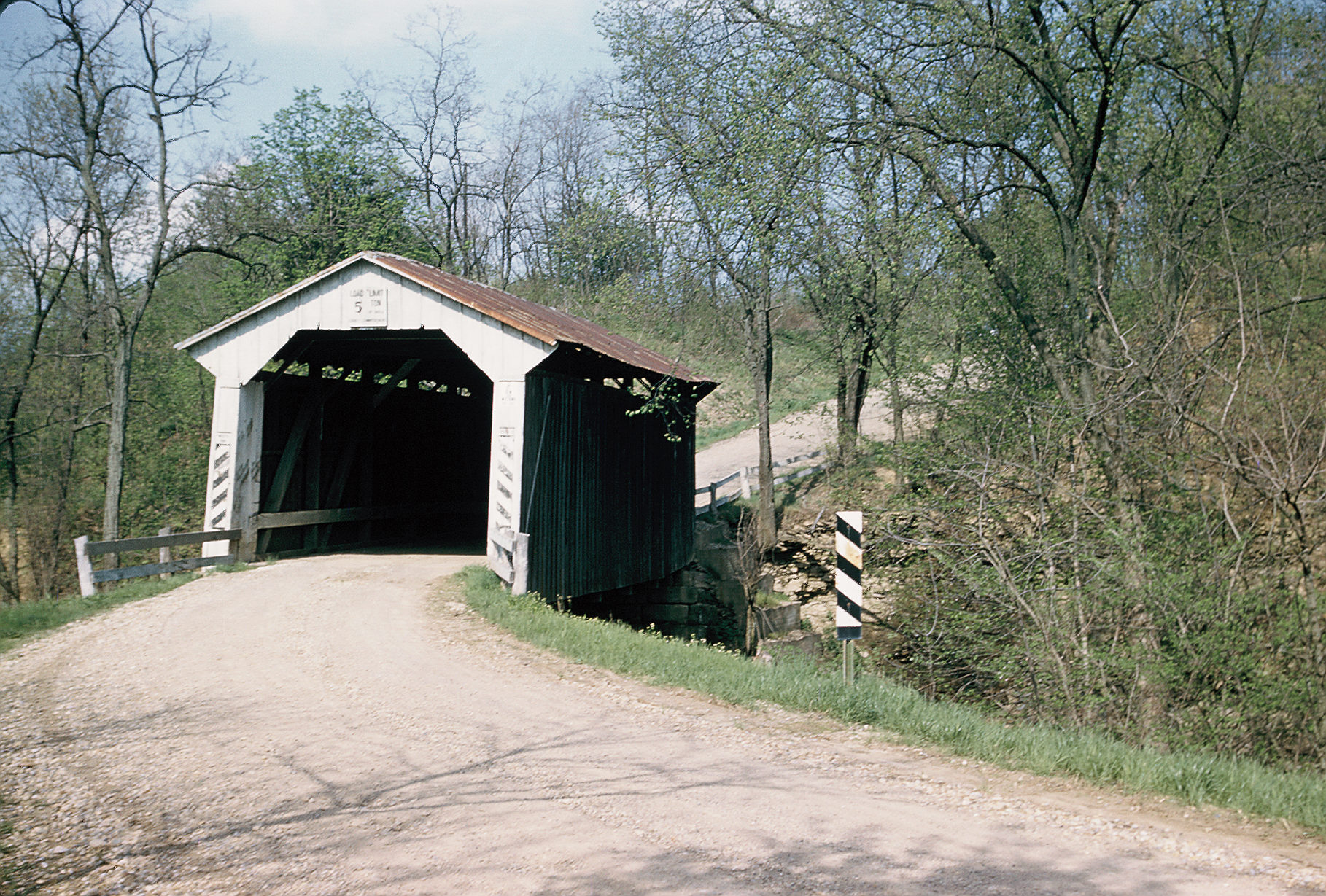
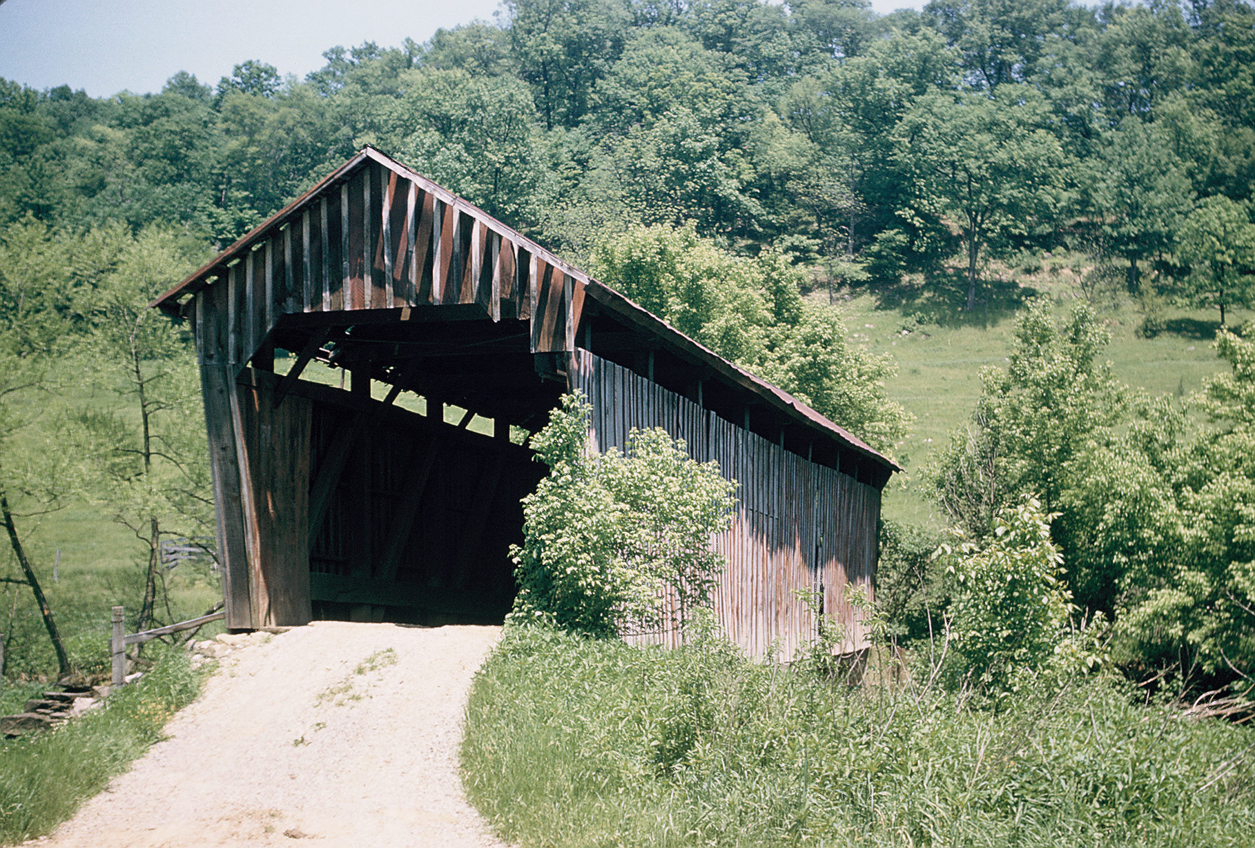
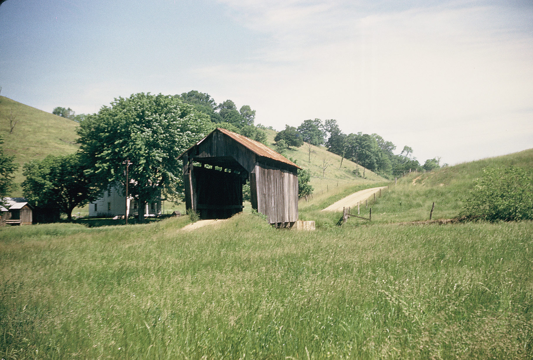
 |
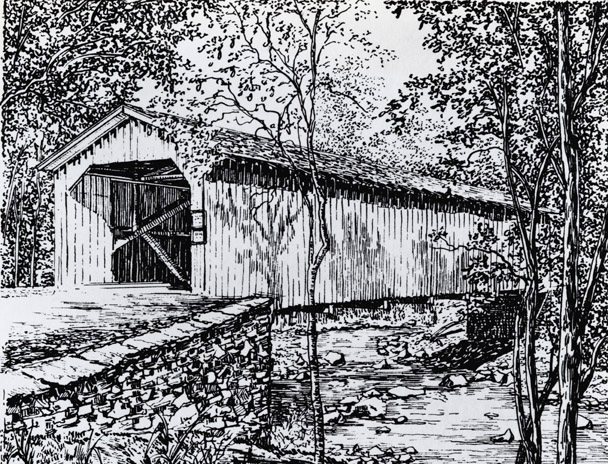
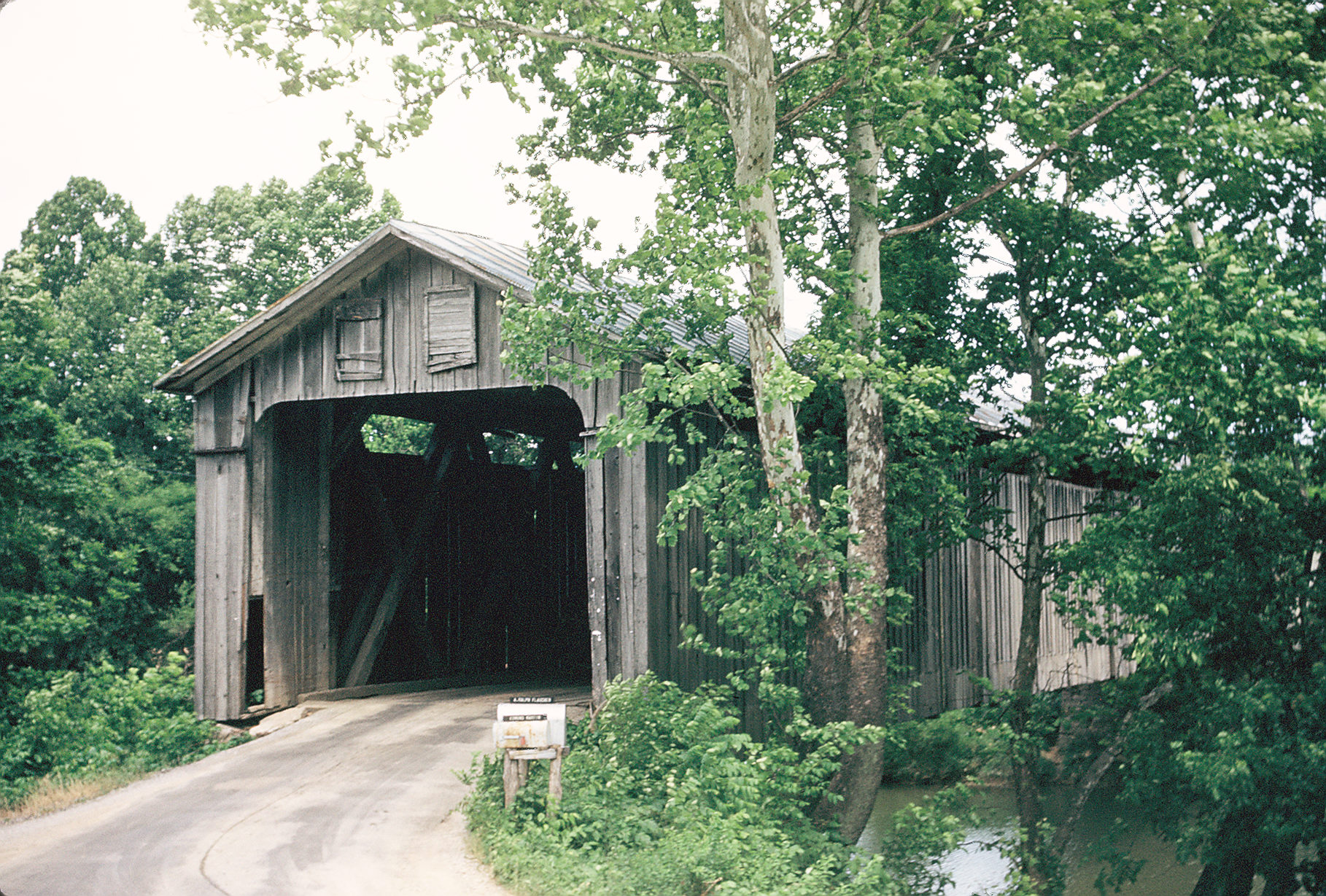
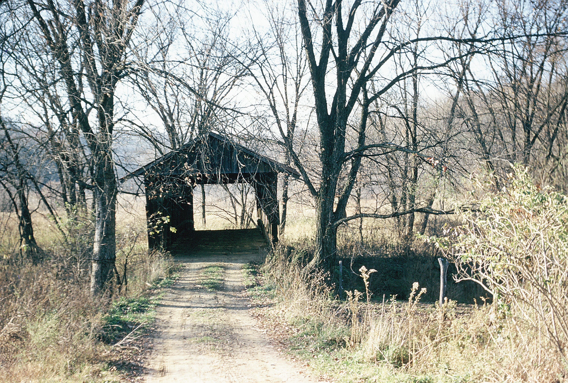
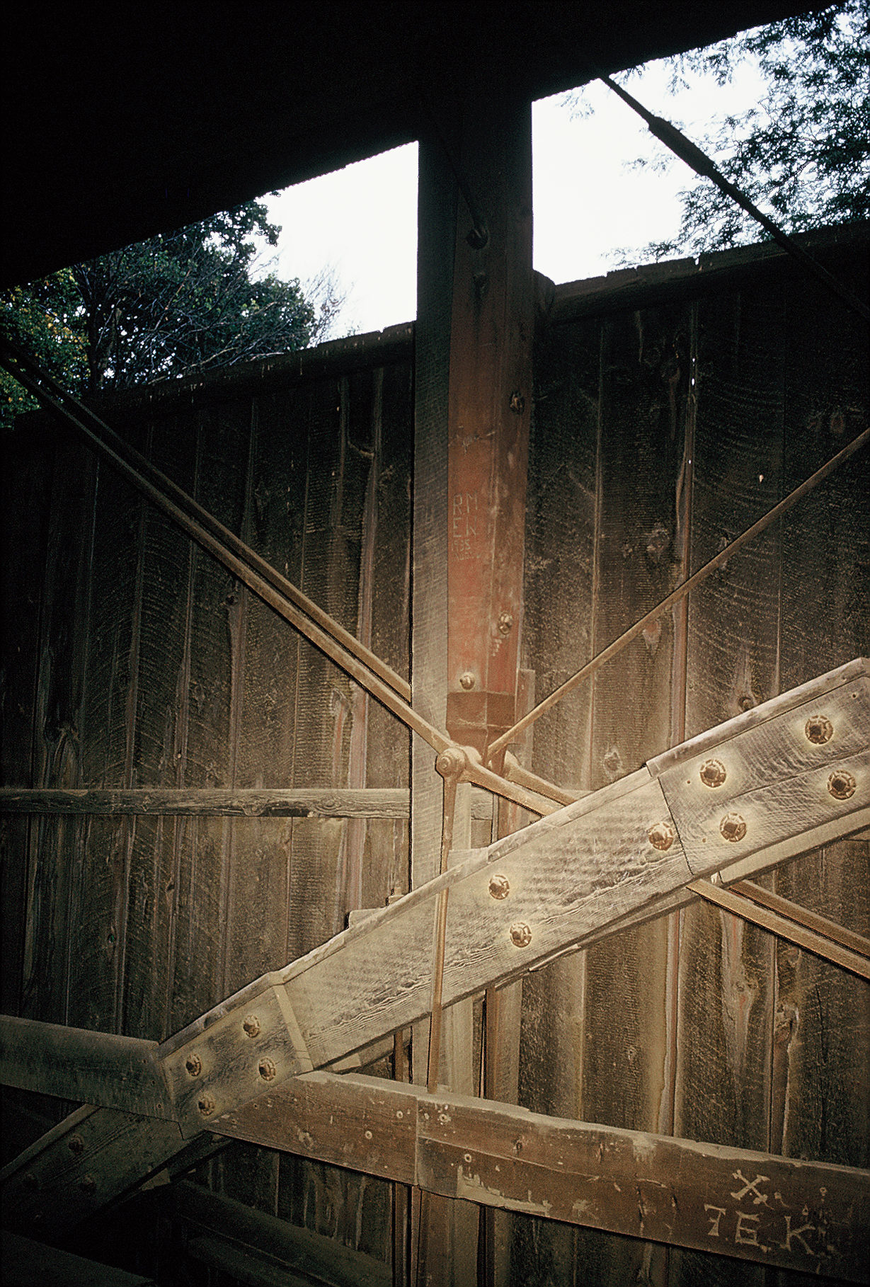
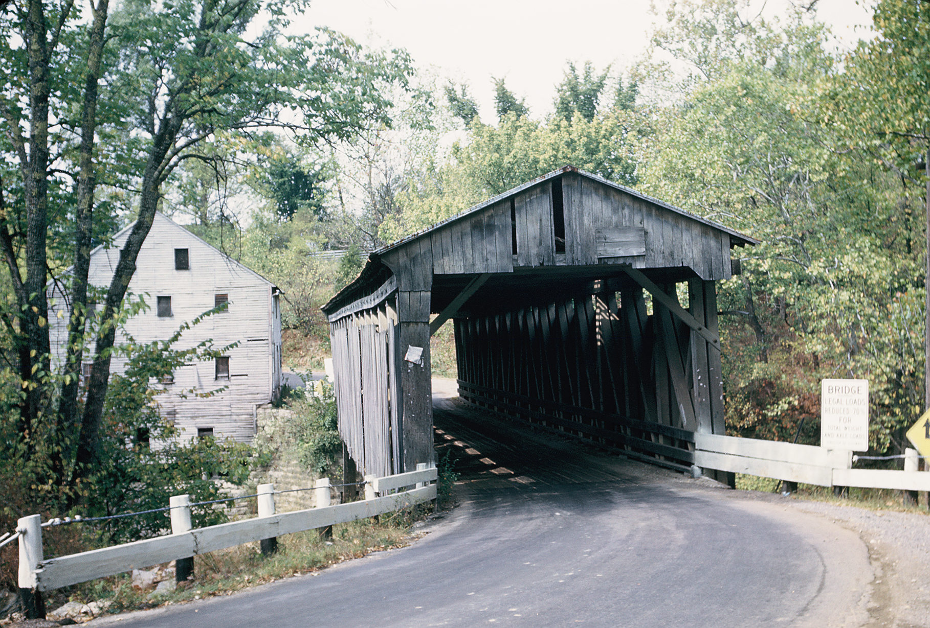
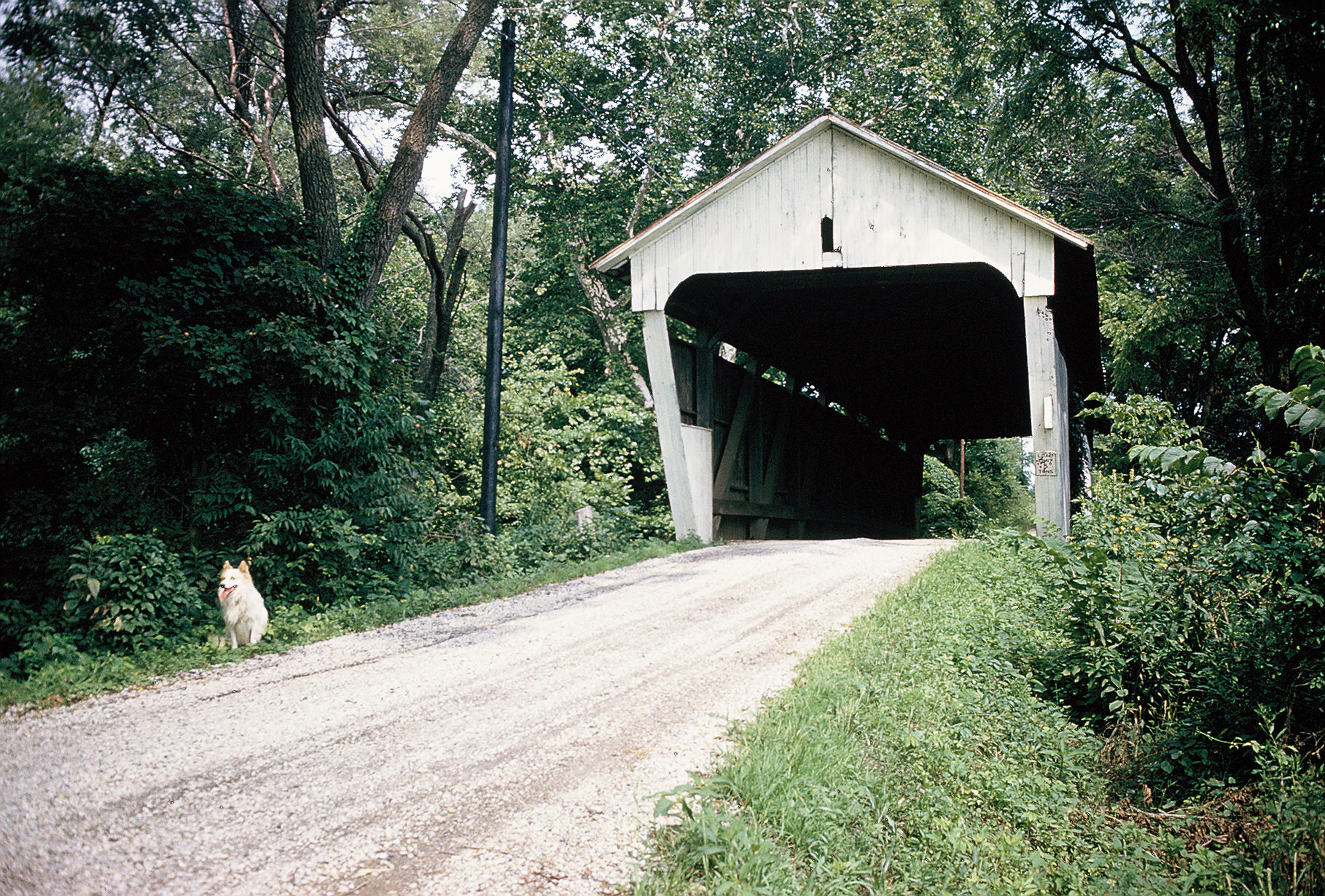
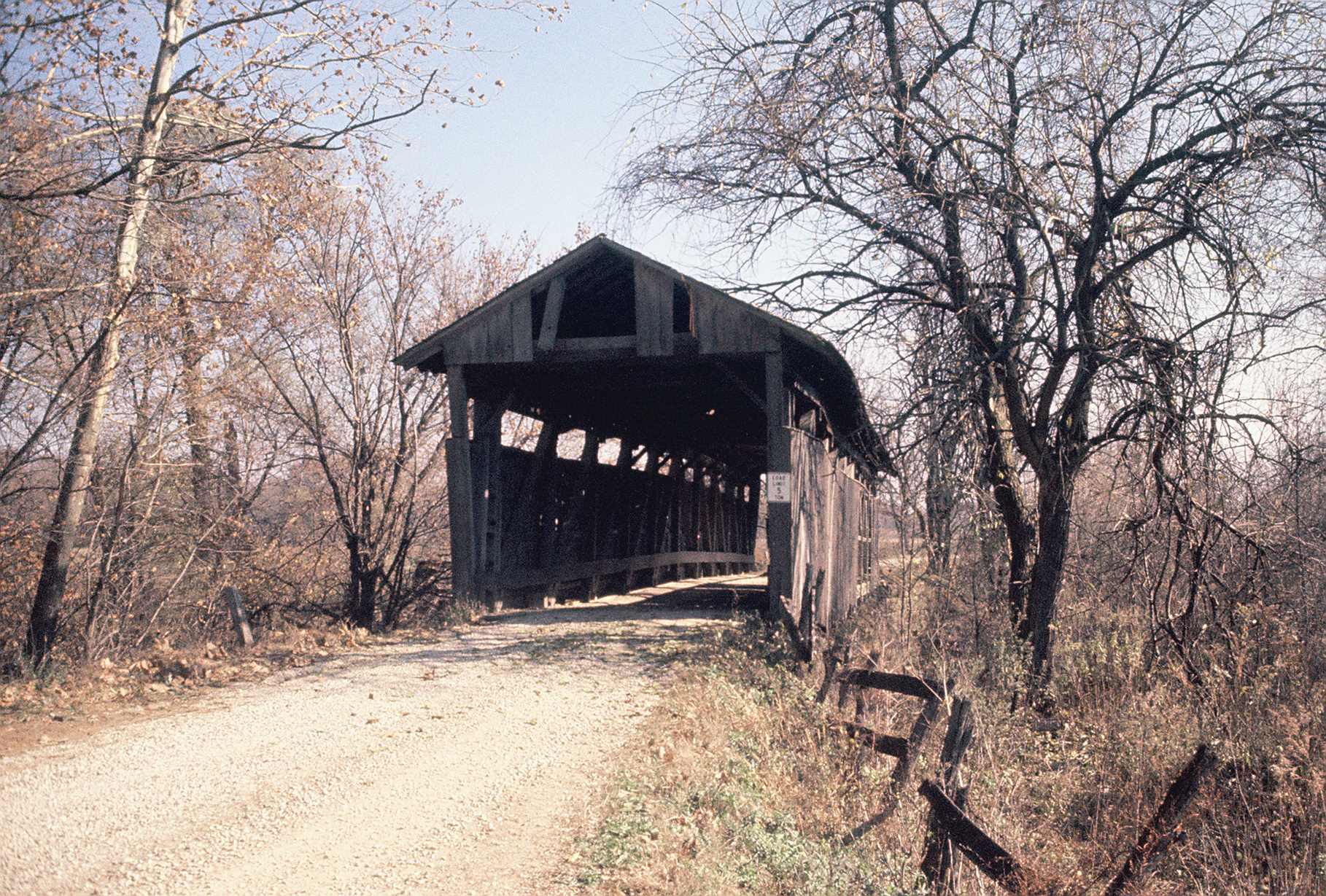
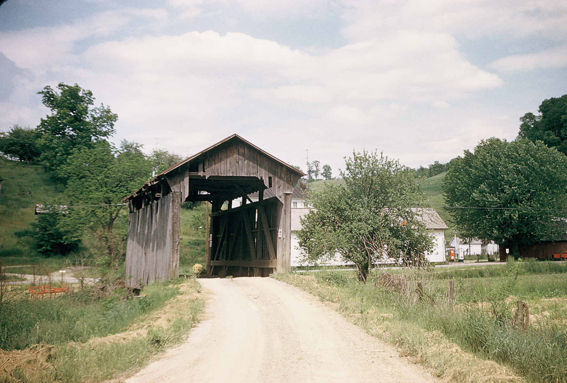
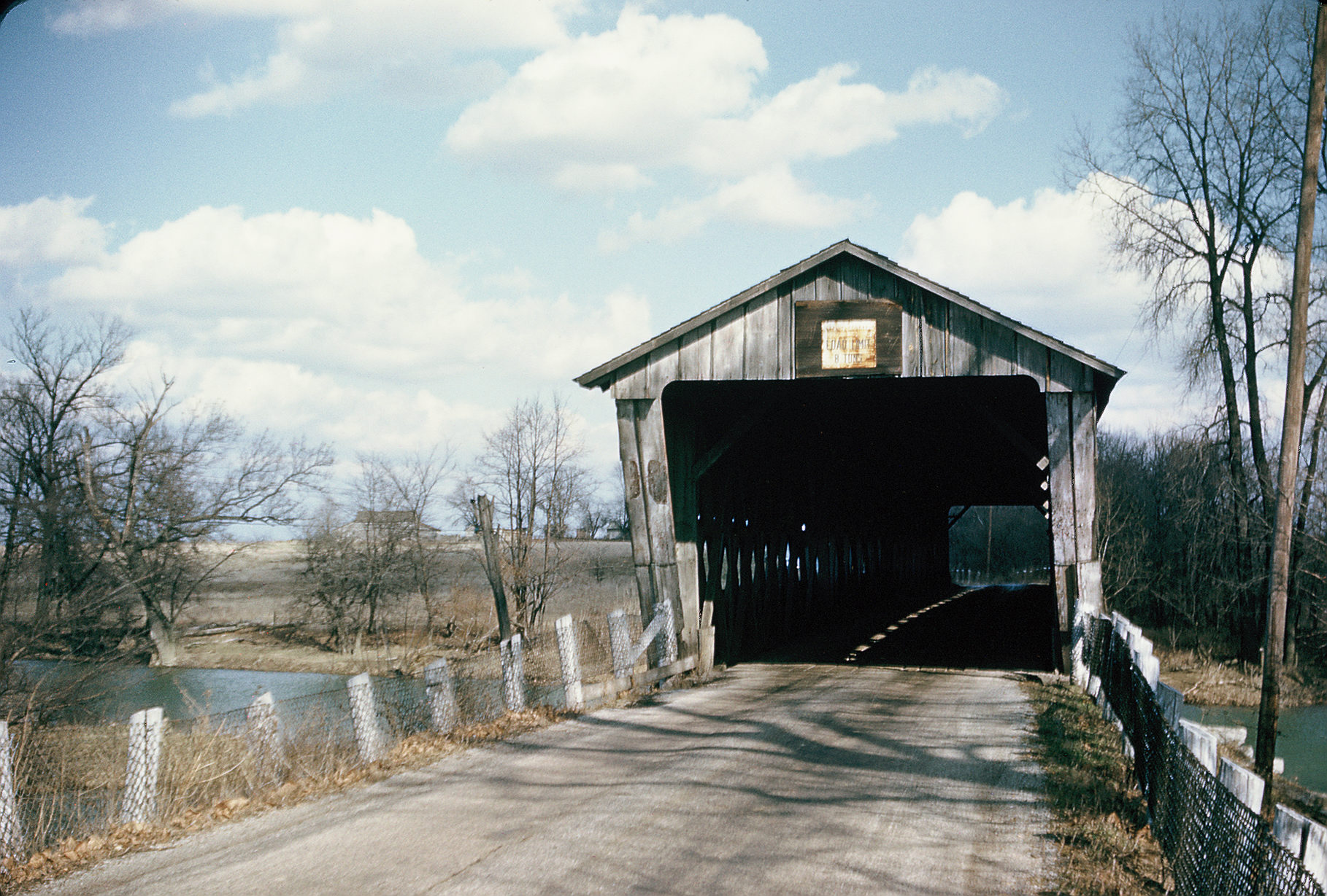
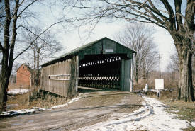
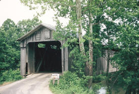
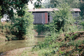
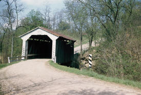
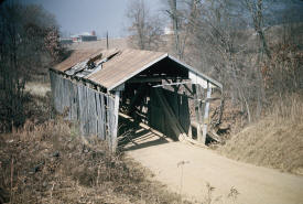
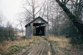
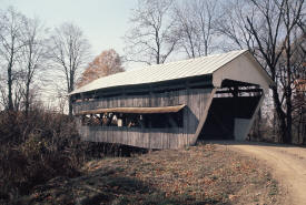
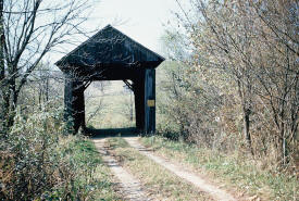
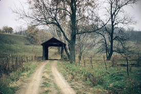
A covered bridge located in
Ashtabula County, Ohio, known as the "Mechanicsville
Bridge," over the Grand River, three miles southwest of
Austinburg, Ohio. This photograph was made on November
7, 1954. A Howe Truss bridge with a single laminated
arch through the truss. The
bridge remains in place today. |
 |
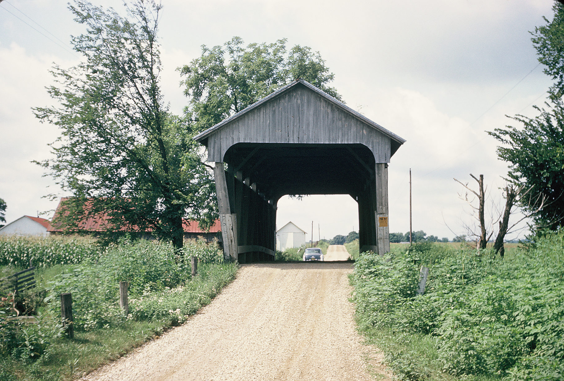
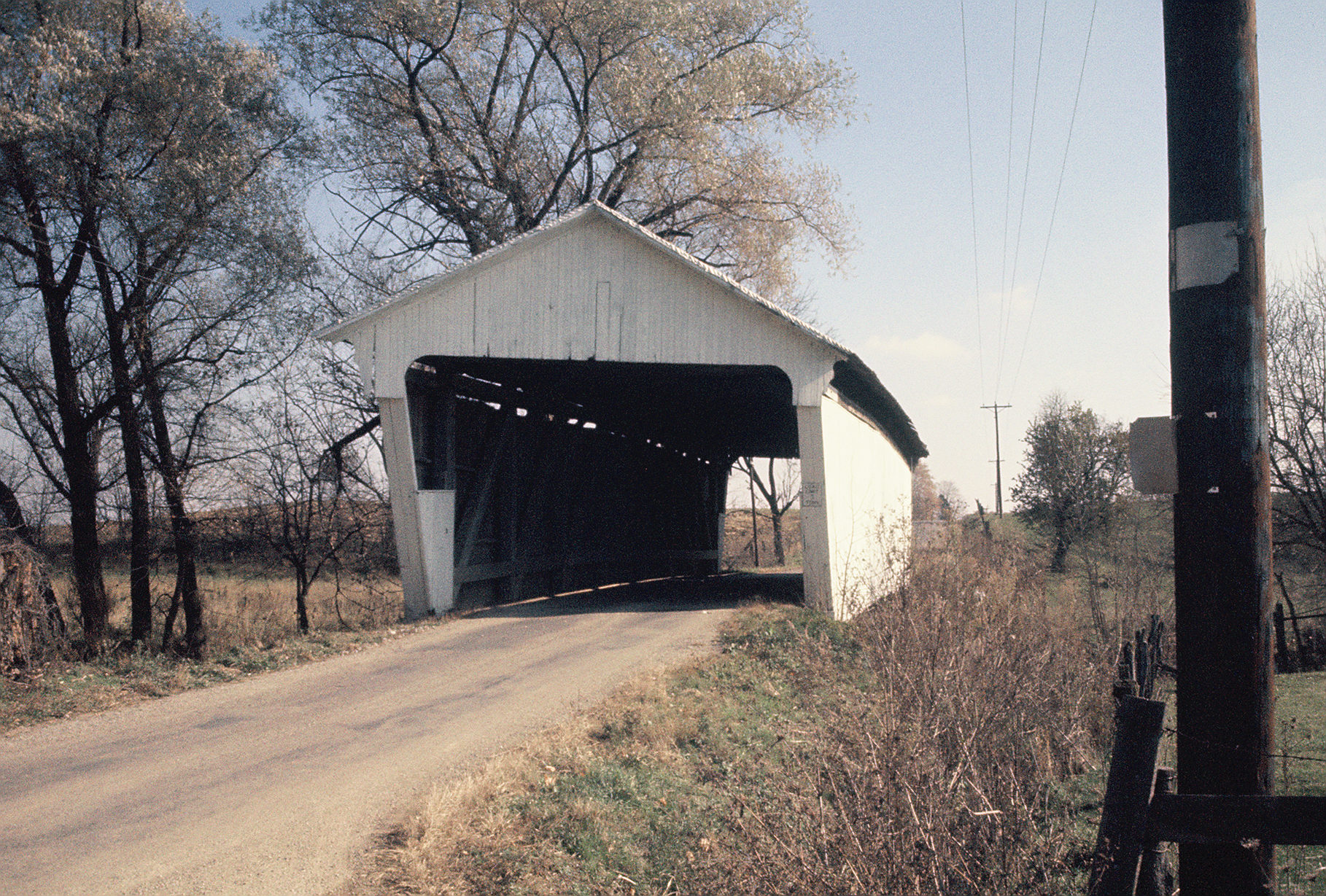
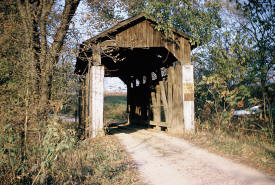
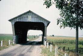
A covered bridge on Ohio State
Route 247 north of Seaman, in Adams County, Ohio. Burr
Arch. Roof evidently sliced off by a truck. This
photograph was made on May 2, 1953.
The bridge is now gone. |
 |
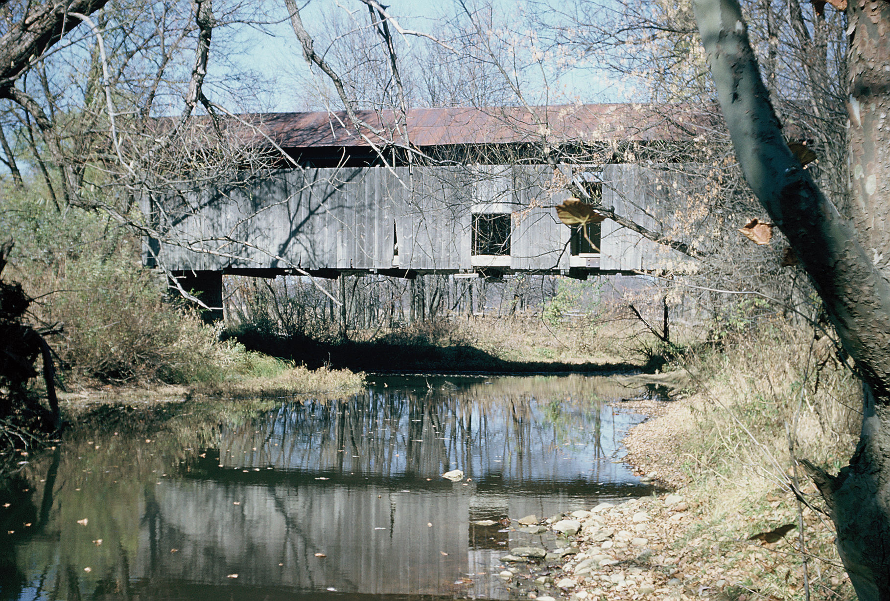
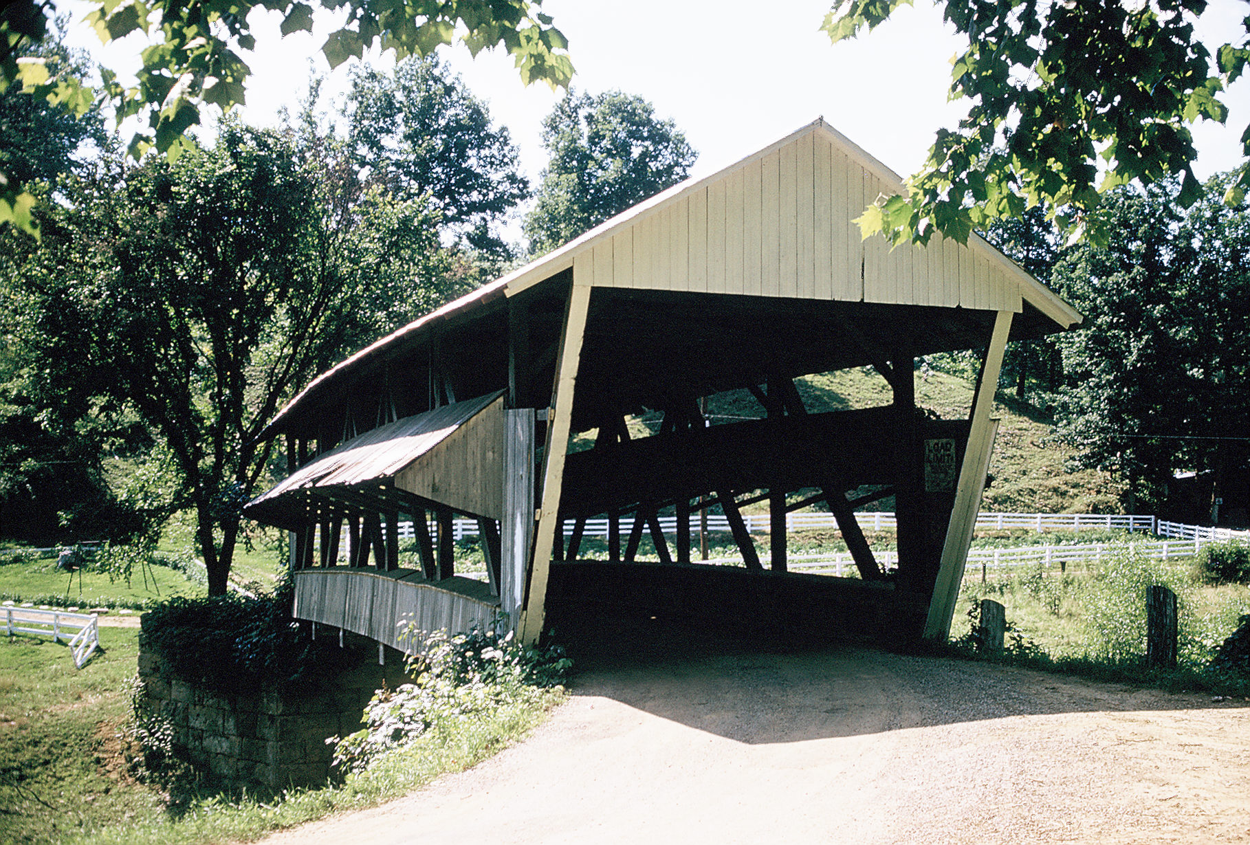
A covered bridge in Ashtabula
County, Ohio, over the Conneaut River, 1/2 mile east of
Kingsville. Photographed on December 5, 1954.
This bridge was abandoned at
the time the photo was taken and is now gone. |
 |
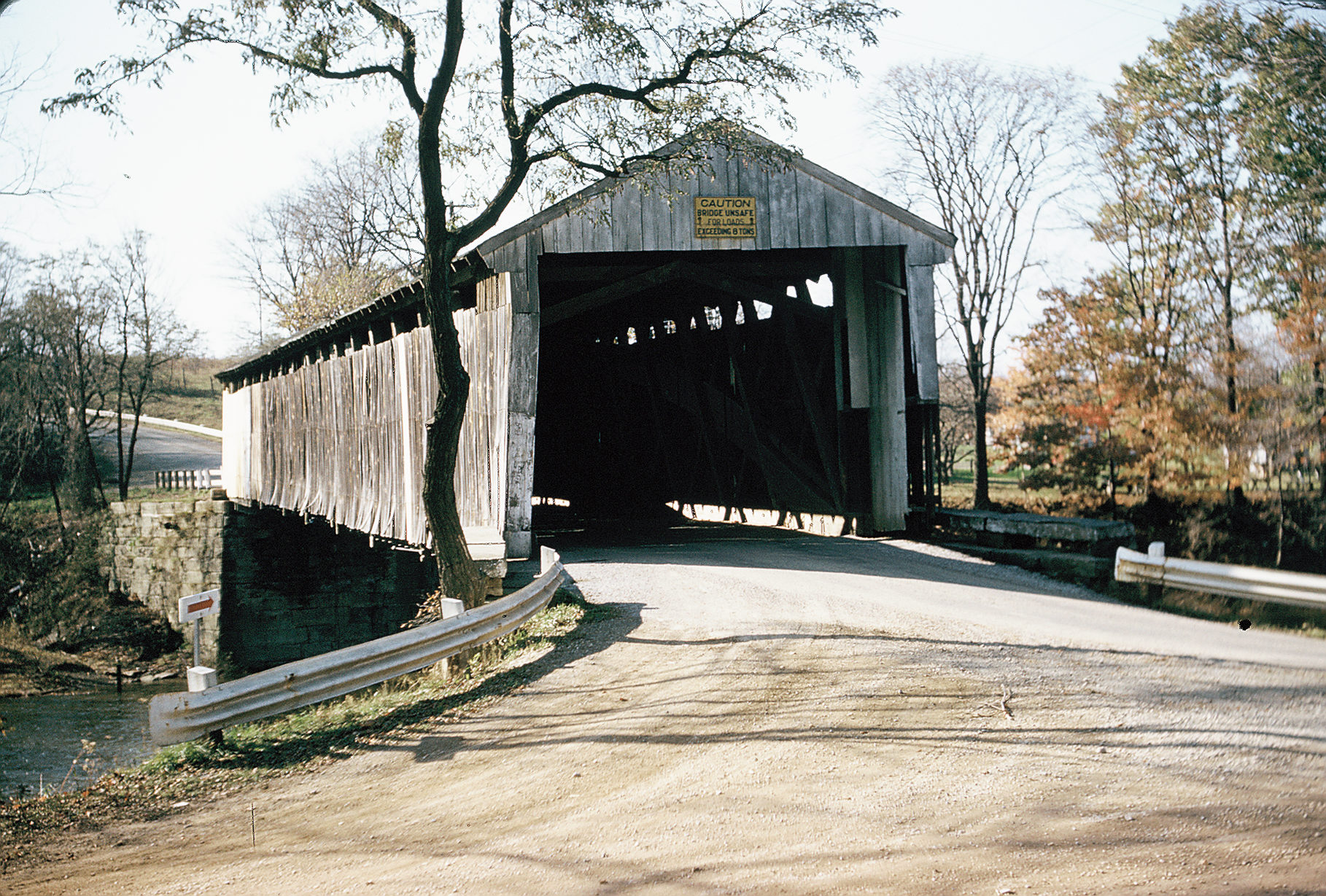
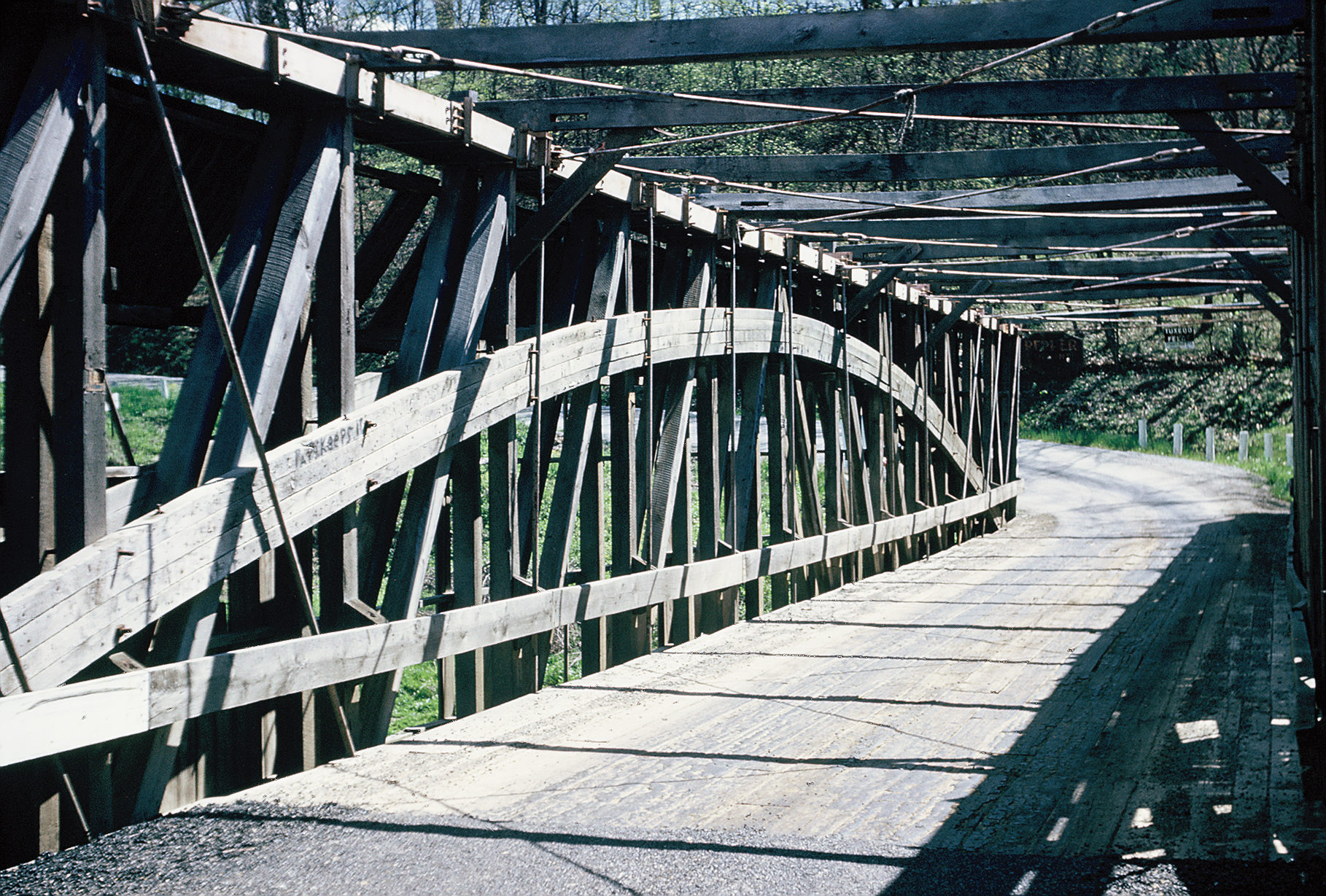
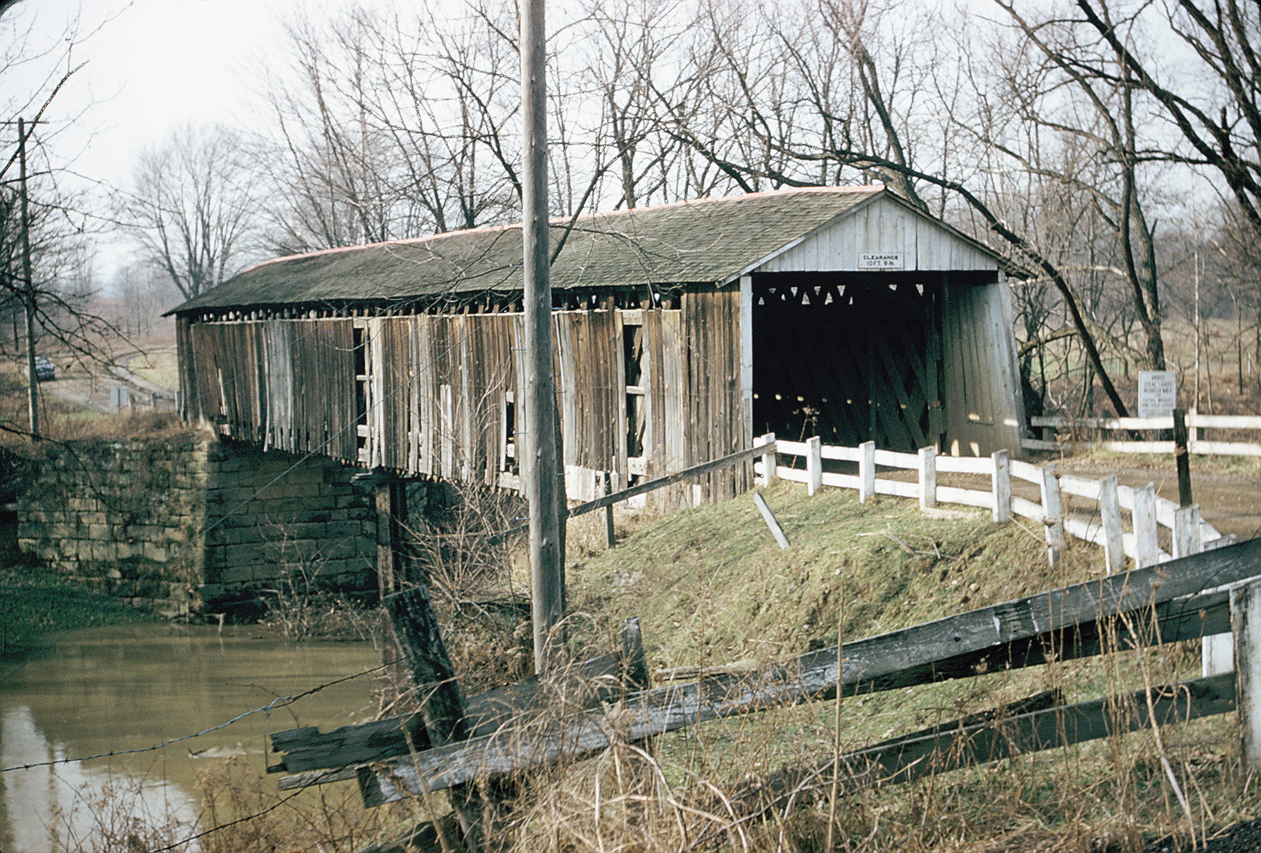
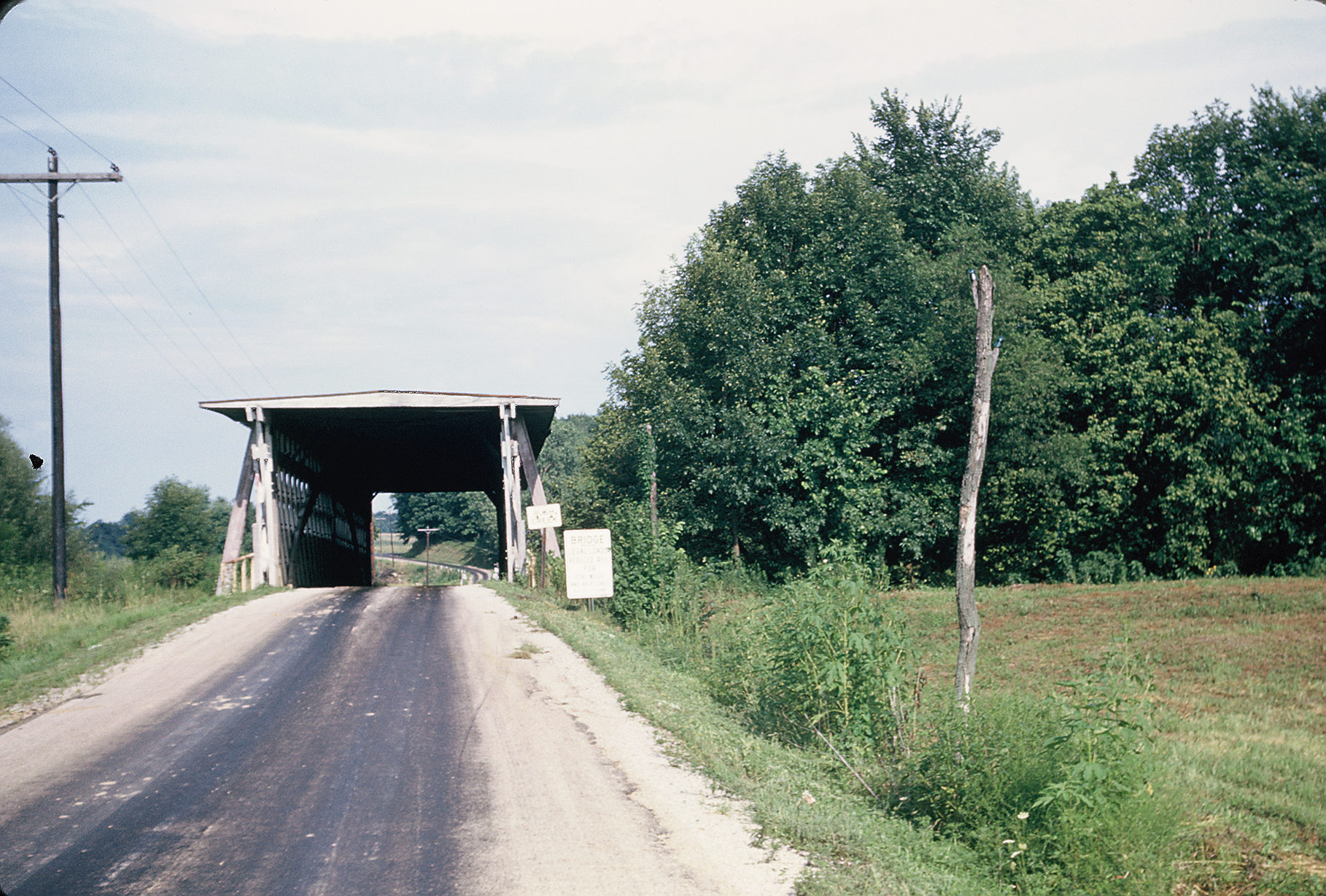
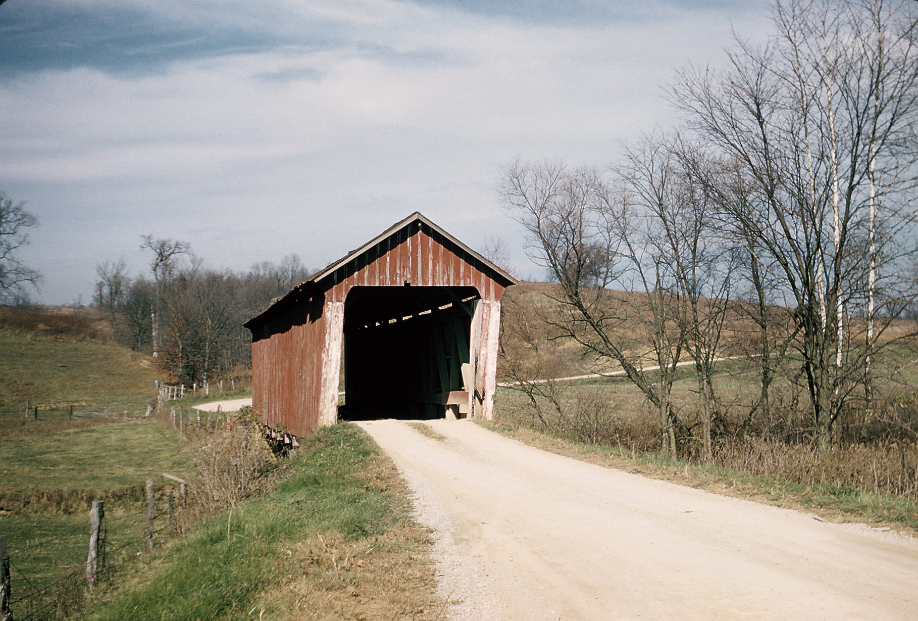
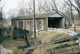
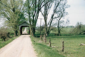
Covered bridge located on an
abandoned section of State Route 167, two miles
northeast of Jefferson, Ohio. Known as the "Riverdale
Road Bridge." The bridge was a Towne Truss style, 102
feet in length, members 3x10, all wood dowelled. The
bridge was abandoned at the time.
It is no longer there. |
 |
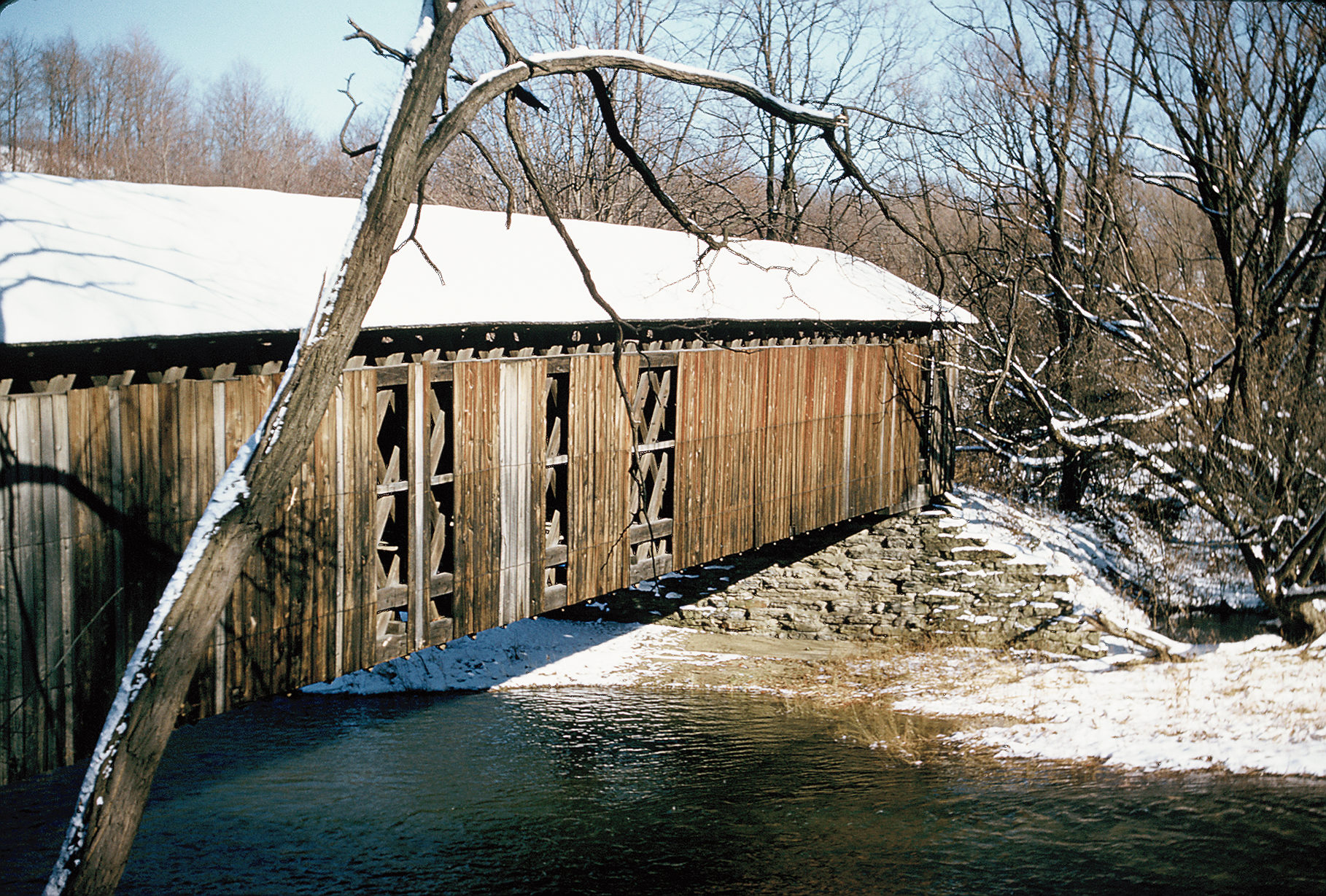
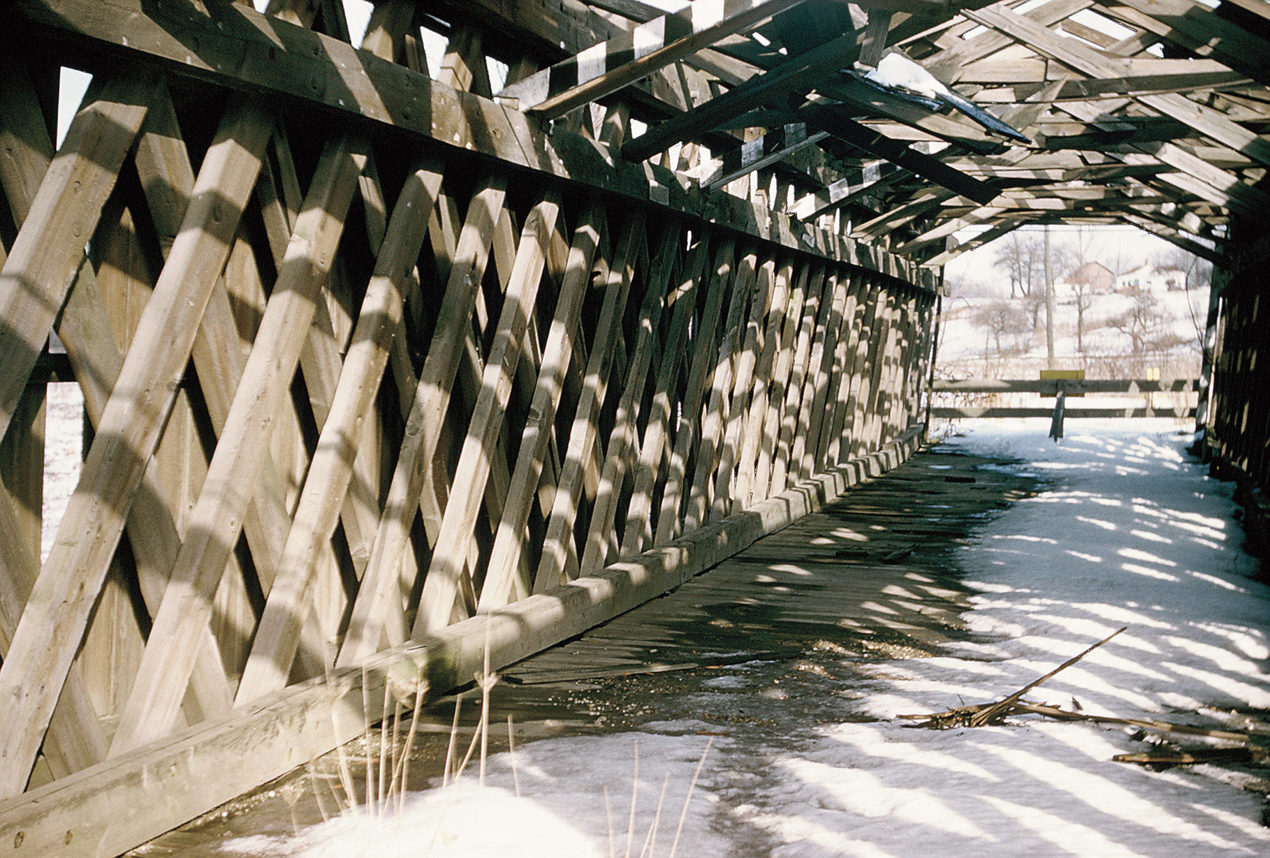
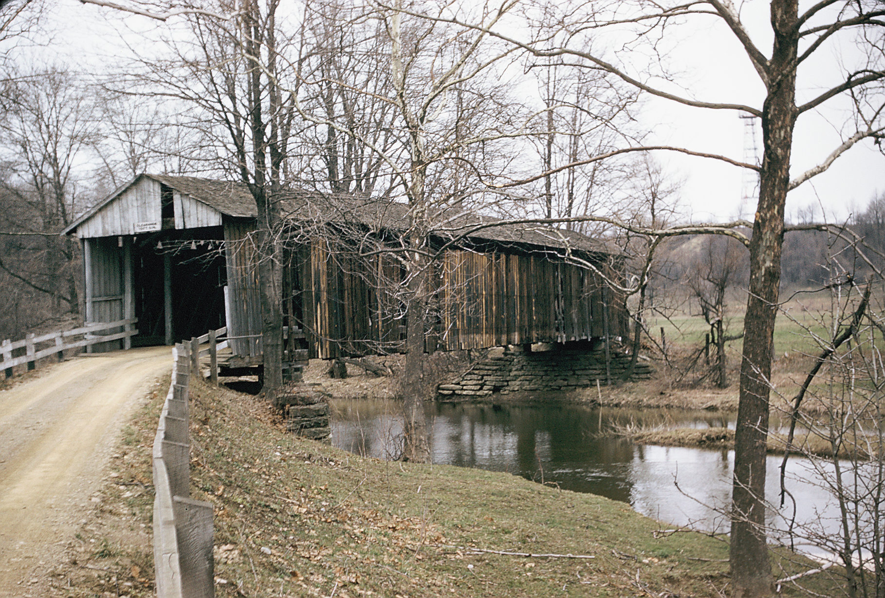
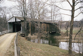
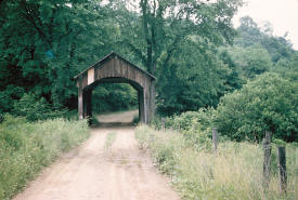
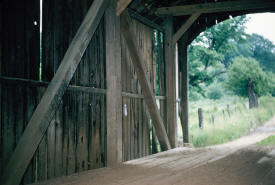
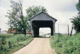
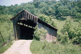
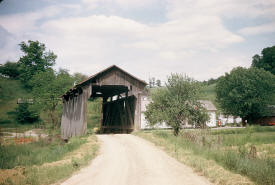
The "Doyle Road Bridge," 1-1/2 miles northewst of
Jefferson, Ohio in Ashtabula County. Towne Lattice Truss
style,90 feet in length, windows in sides, all wood
dowelled. Photographed on December 26, 1954.
The bridge is still in place. |
 |
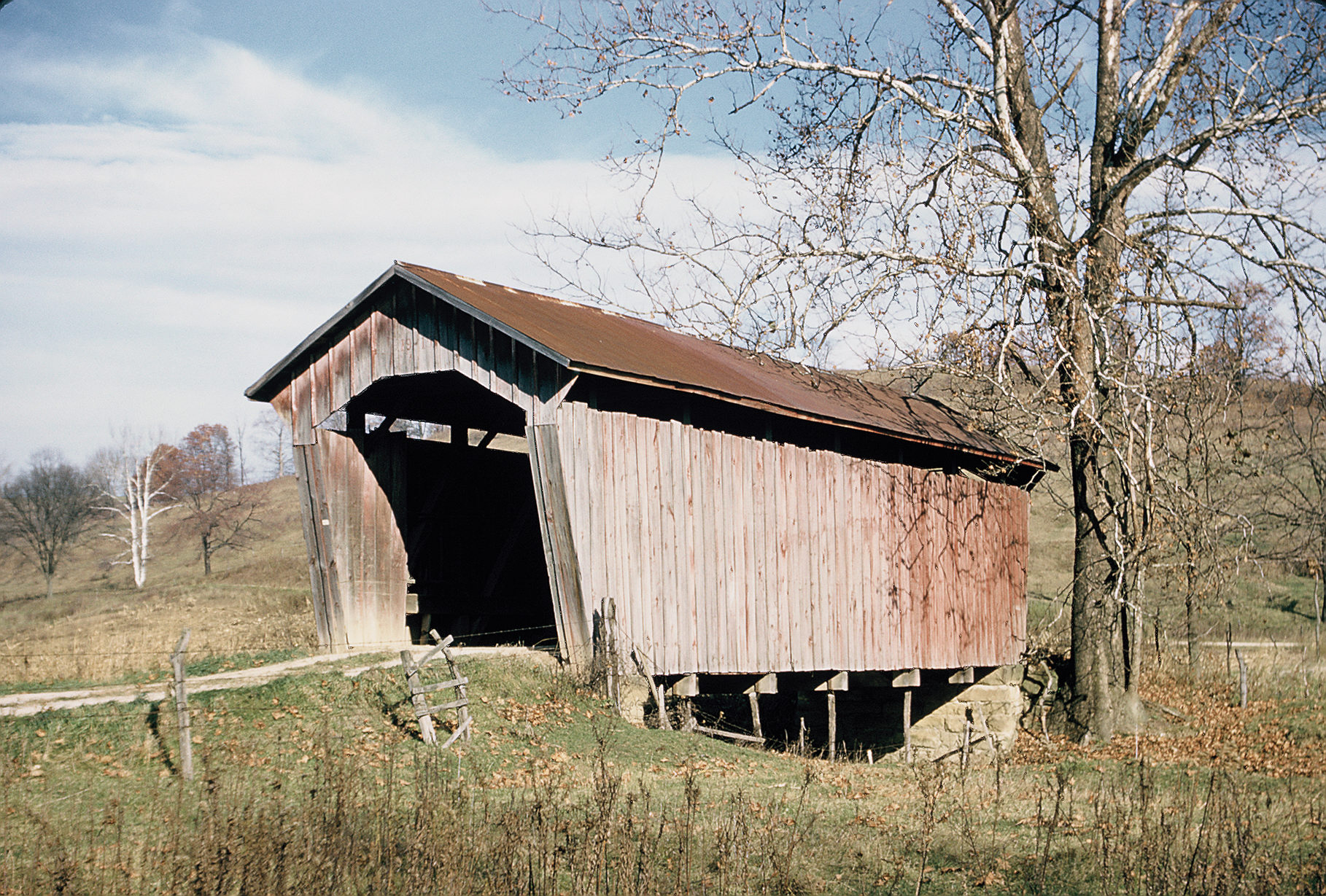
The "Riverdale Road Bridge," over the Grand River 1-1/2
miles northwest of Rock Creek, Ohio in Ashtabula County.
Towne Lattice Truss style, 123 feet in length.
The bridge still exists. |
 |
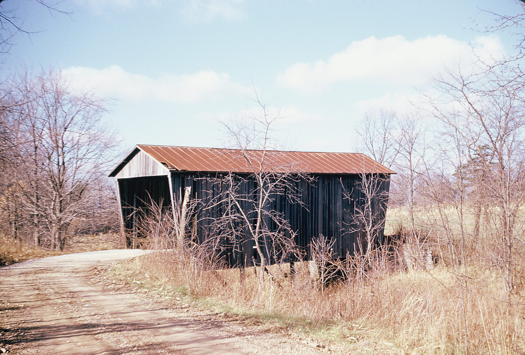
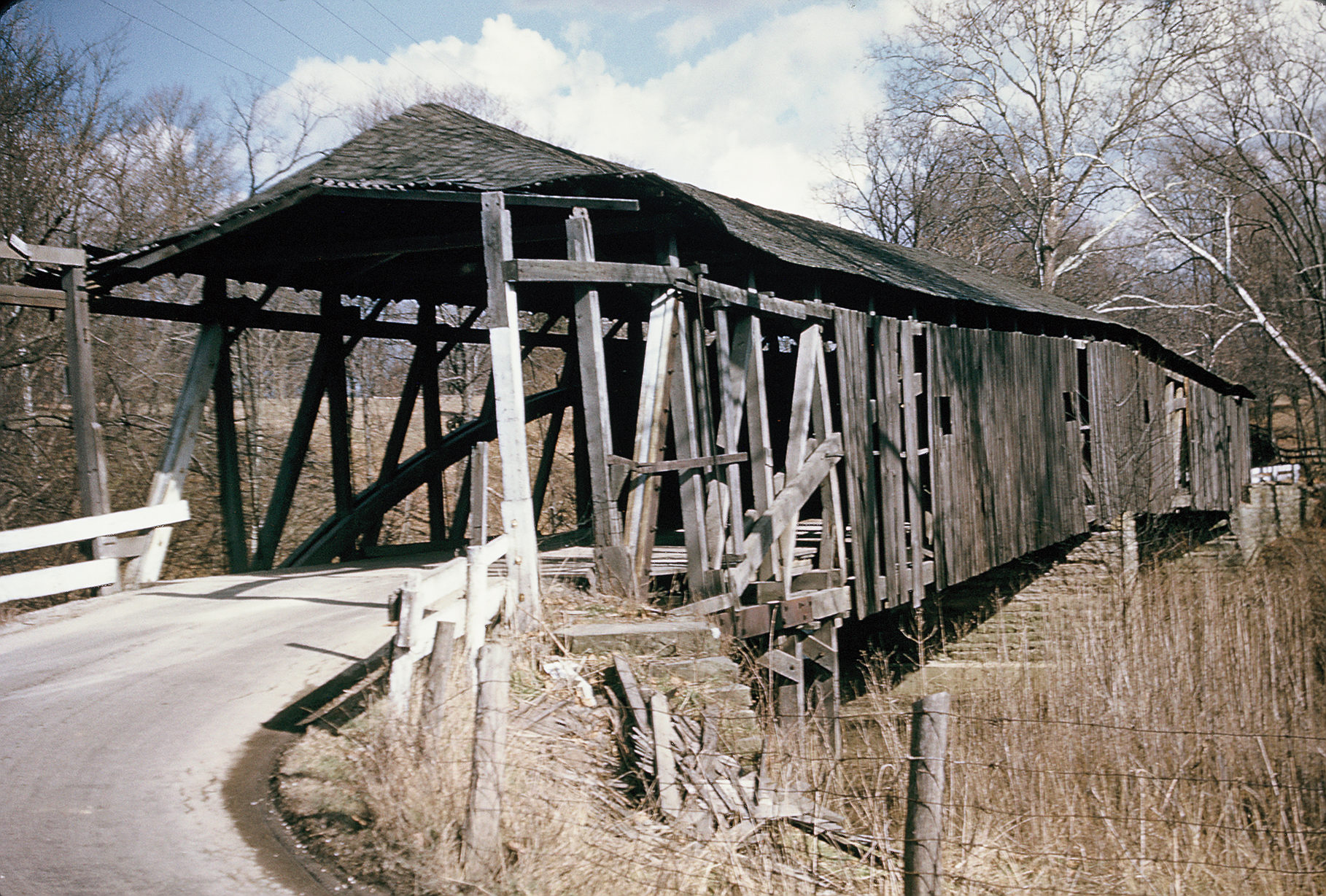
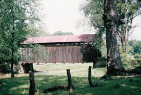
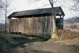
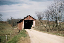
The "Benetka Road Bridge," 112 feet
in length, over the Ashtabula River near Sheffield in
Ashtabula County. A Towne Truss construction,
photographed on April 3, 1955.
Not sure of this bridge continues to exist. |
 |
Covered bridge on State Route 251 near St. Martin, Brown
County, Ohio. Over East Fork of Little Miami River. 111
feet long, double solid wood arches and truss.
Photographed May 17, 1952. This
bridge is now gone. |
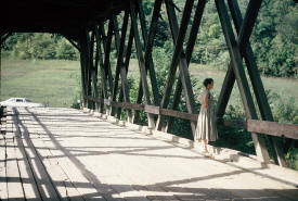 |
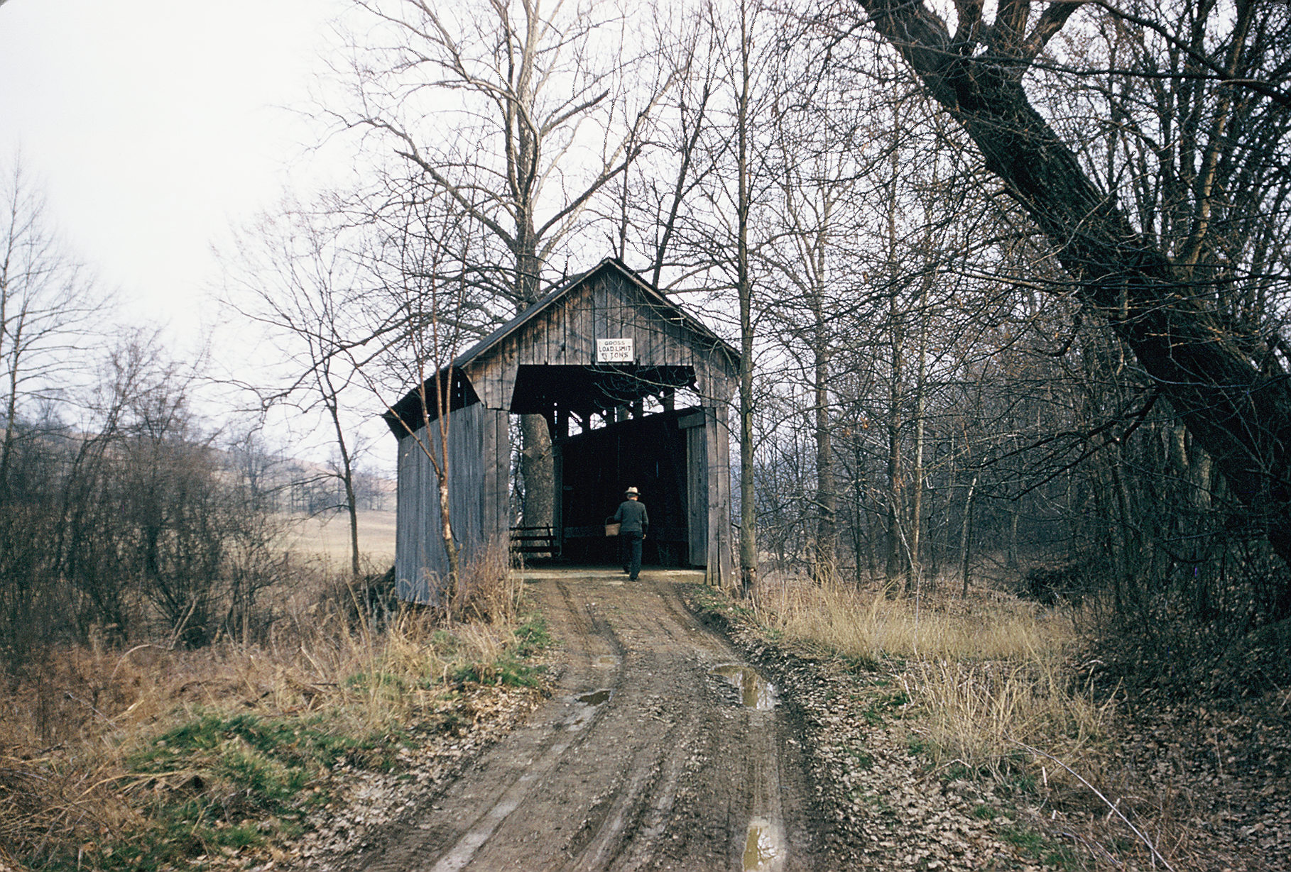
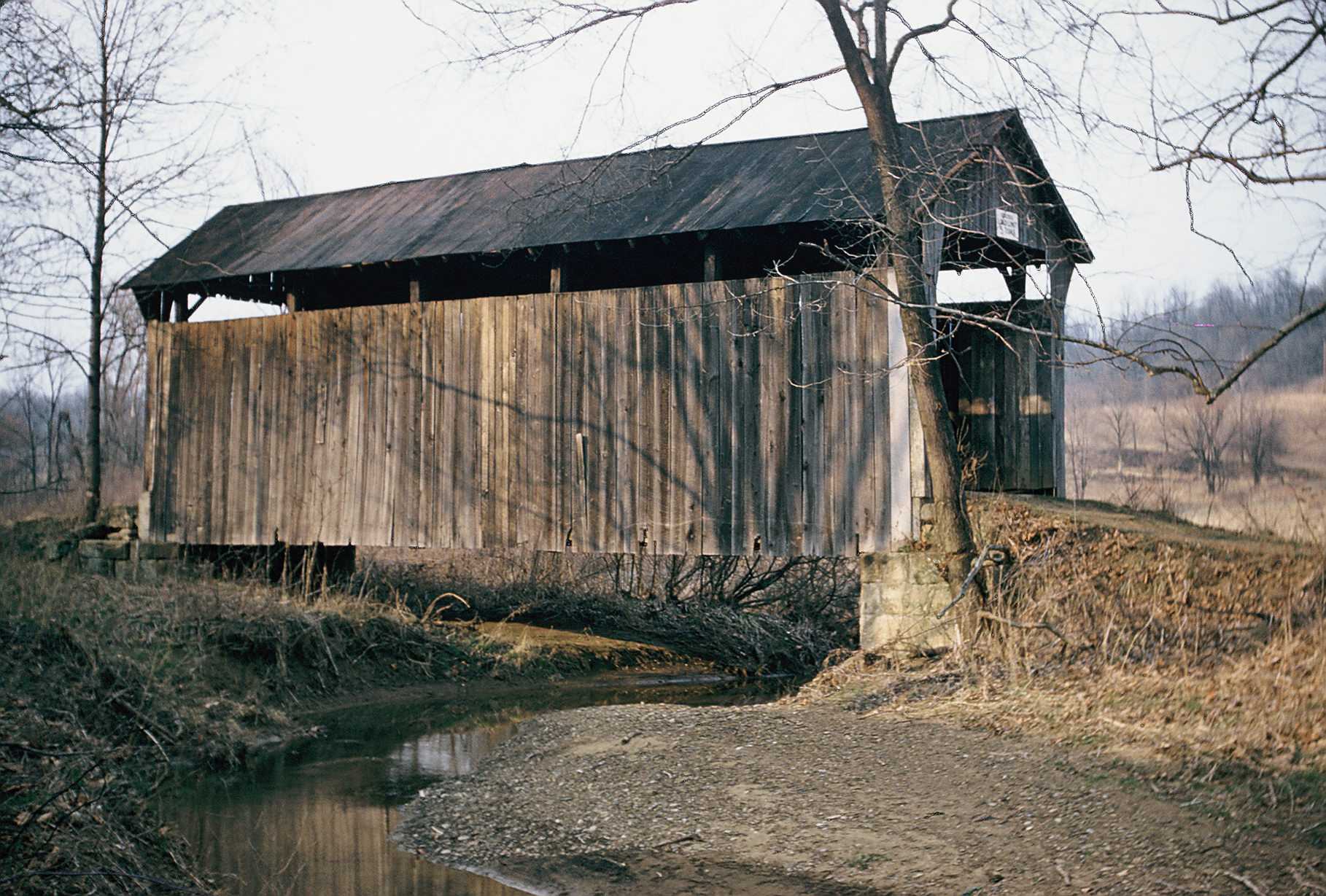
Covered bridge on State Route 763 in Brown County, Ohio.
158 feet long, characterized as "badly neglected when
photo was taken on August 31, 1952.Steel splice plates
on fire damaged truss members. This bridge is now gone.
The woman who appears on this bridge is Eileen Keller,
Traug Keller's wife. The
bridge is now gone. |
 |
This covered bridge was thought by Traug Keller to be
the shortest in Ohio, but in fact it was not. Traverse
Five Mile Creek on Blue Sky Park Road, .7 miles from
Clermont County line in Brown County. Photographed on
November 27, 1952. The bridge
is now gone. |
 |
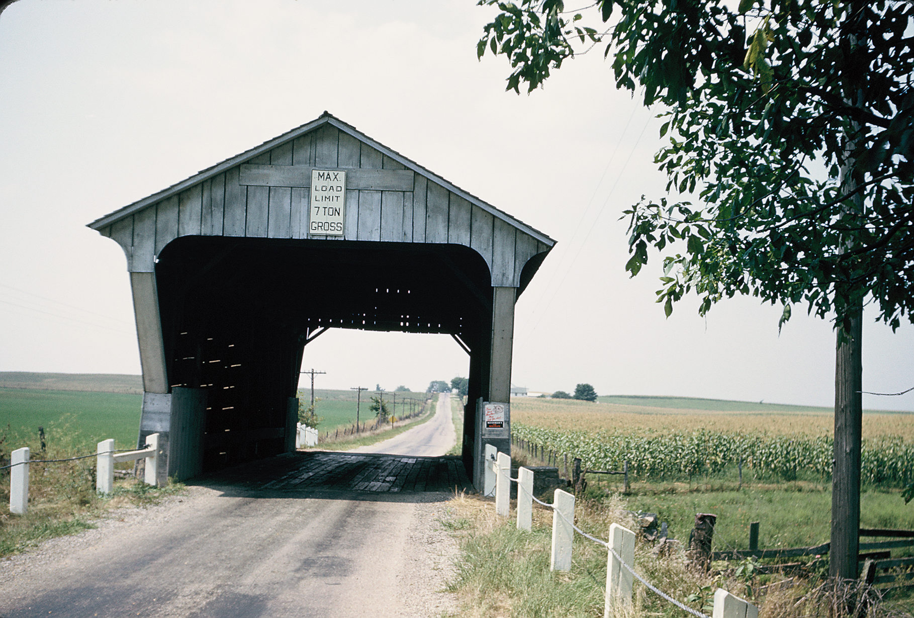
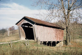
Covered Bridge on North Pole Road, 3.3 mils east of
State Route 62. 165 feet in length; date carved on the
bridge is 1908. Photographed on June 6, 1953.
The bridge remains in place. |
 |
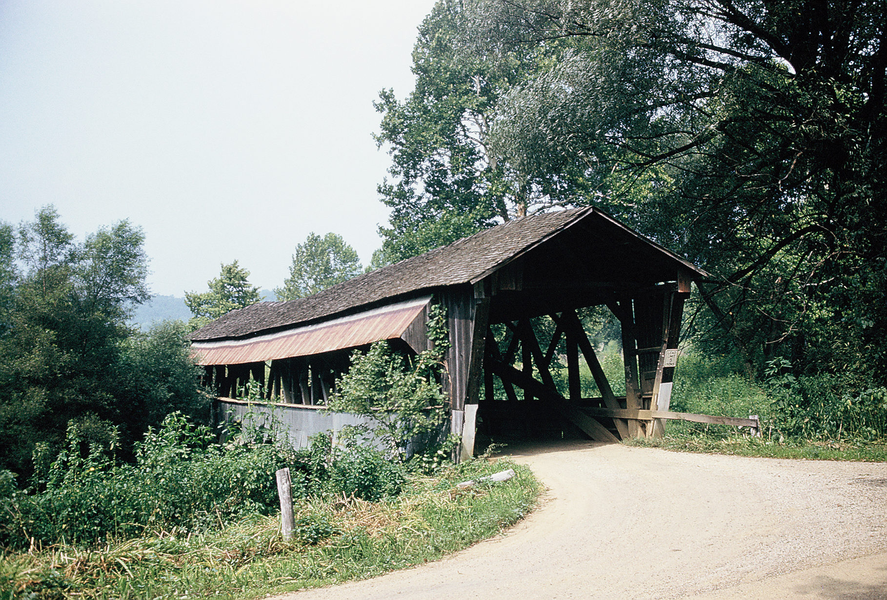
Covered bridge over Stonelick Creek in Clermont County,
Ohio about three miles east of Perintown on Stonelick-Williams
Corner Road. A Howe Truss design characterized by Traug
Keller as in "fine condition, the bridge was 140 feet
long. The bridge remains in
place. |
 |
Covered bridge known as the "McLellan Bridge in
Columbiana County, Ohio. Runs over the west fork of
Little Beaver Creek 5 miles east/southeast of Haverton.
Photographed on May 28, 1955, the bridge is 51 feet in
length, all wood doweled, all oak, with a date of June
20, 1901 carved into it. The
bridge is now abandoned and in poor condition, but
remains in place. |
 |
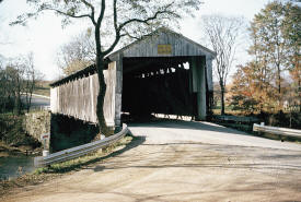
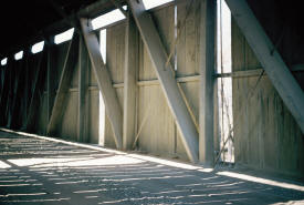
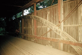
This covered bridge is actually the shortest in Ohio.
Called the Church Hill Road Bridge, it was originally at
the junction of State Route 517 and North Edge Road,
over Middle Run. Photographed on June 23, 1956, the
bridge was dated 1908. It was
moved to Elkton, Ohio in 1982 and remains in existence. |
 |
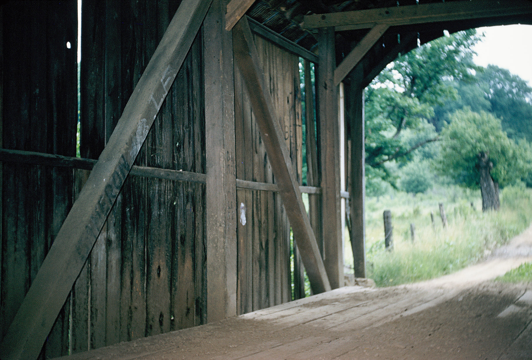
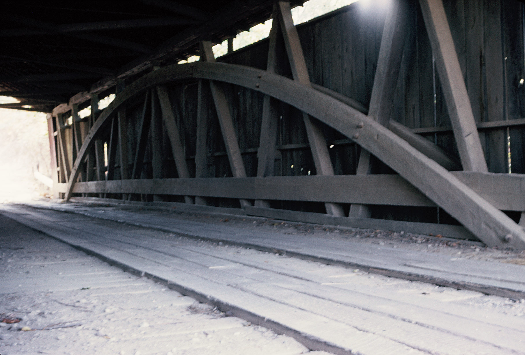
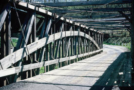
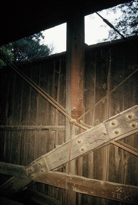
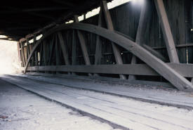
This is an
interior view of the bridge above. |
 |
A covered bridge in Coshocton
County, Ohio over Doughty Creek, three miles northeast
of Blissfield. The bridge had an arched floor similar to
a humpback bridge. Photographed November 5, 1955. There
was an effort To move the bridge for preservation to the
Roscoe Village Museum in Coshocton, but the timbers were
stored outside until they rotted away to nothing.
The bridge is now gone. |
 |
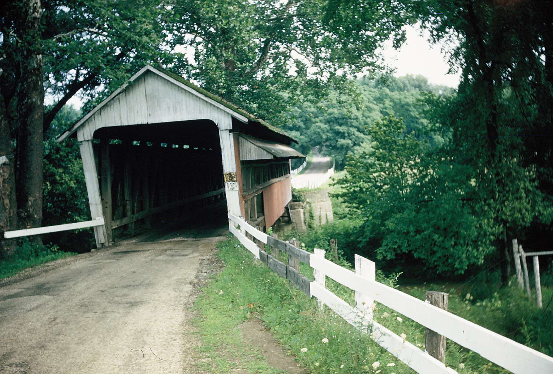
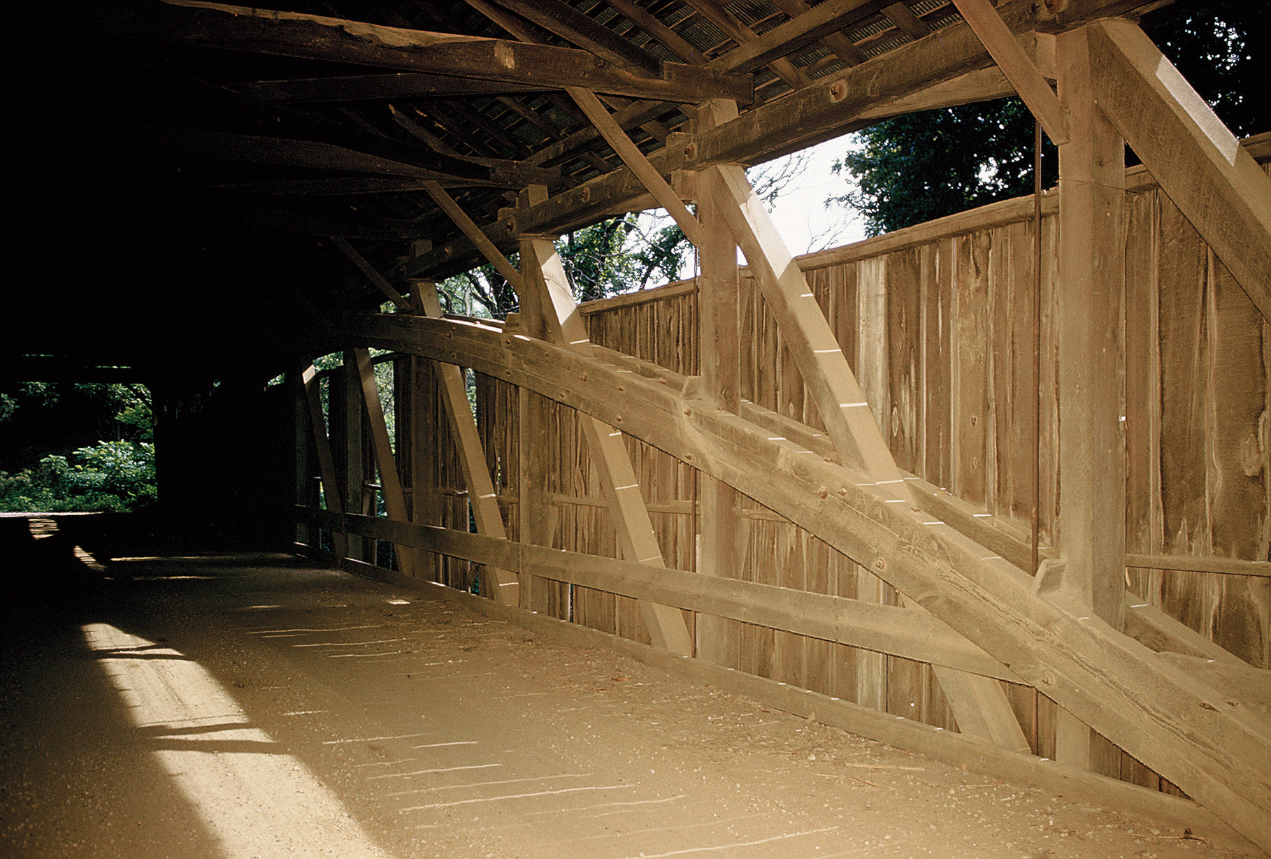
Covered bridge over Big Walnut
Creek on Sunbury Road south of Galena in Delaware
County, Ohio. 198 feet in length, featuring burr
trusses. The date of 1884 was carved in the timber.
Photographed on February 8, 1953.
The bridge is now gone. |
 |
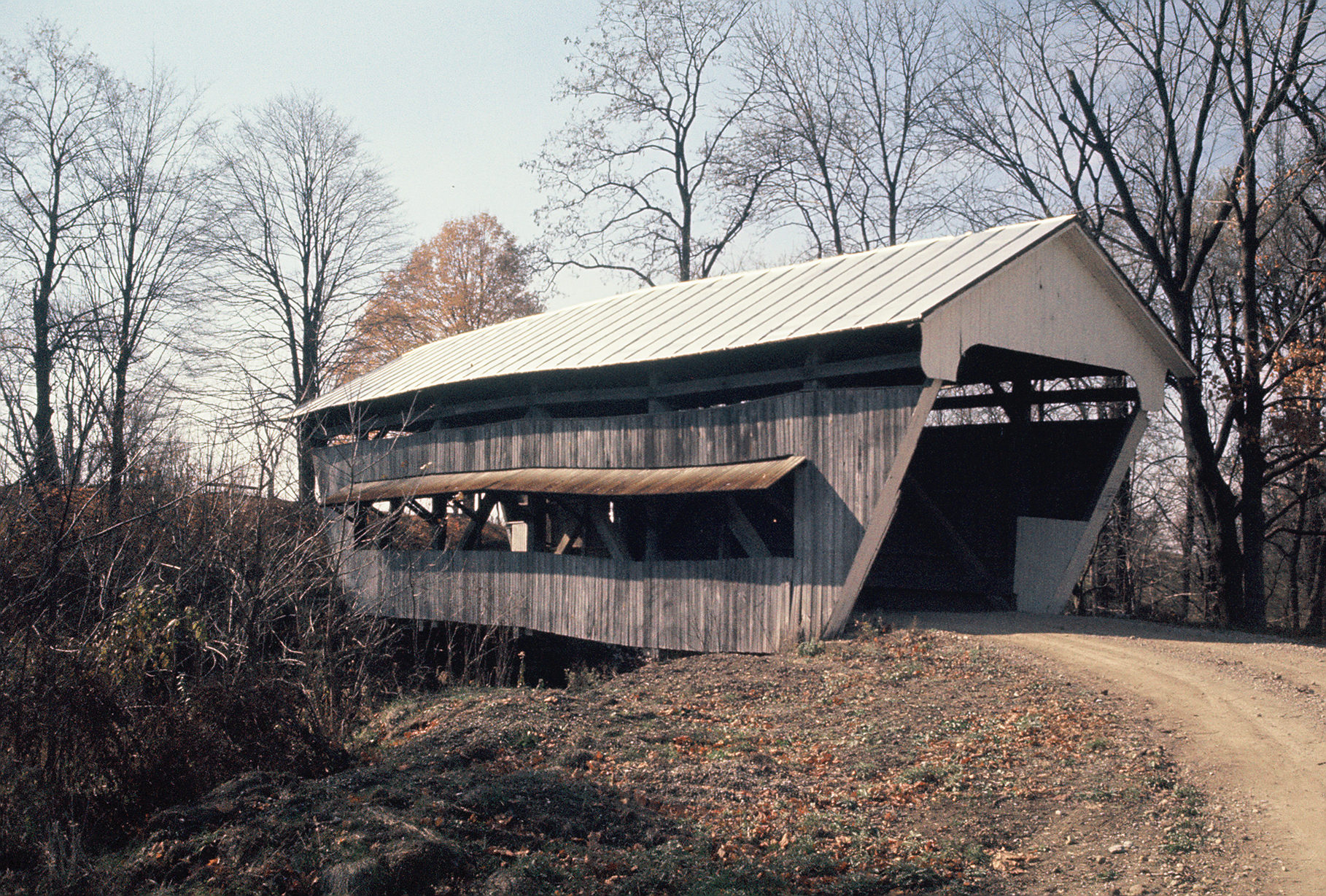
The "Chamber Road Bridge," located in Delaware County,
Ohio 1.5 miles northeast of Olive Green. 70 feet in
length, Childs Truss design. Photographed October 31,
1953. The bridge remains in
place. |
 |
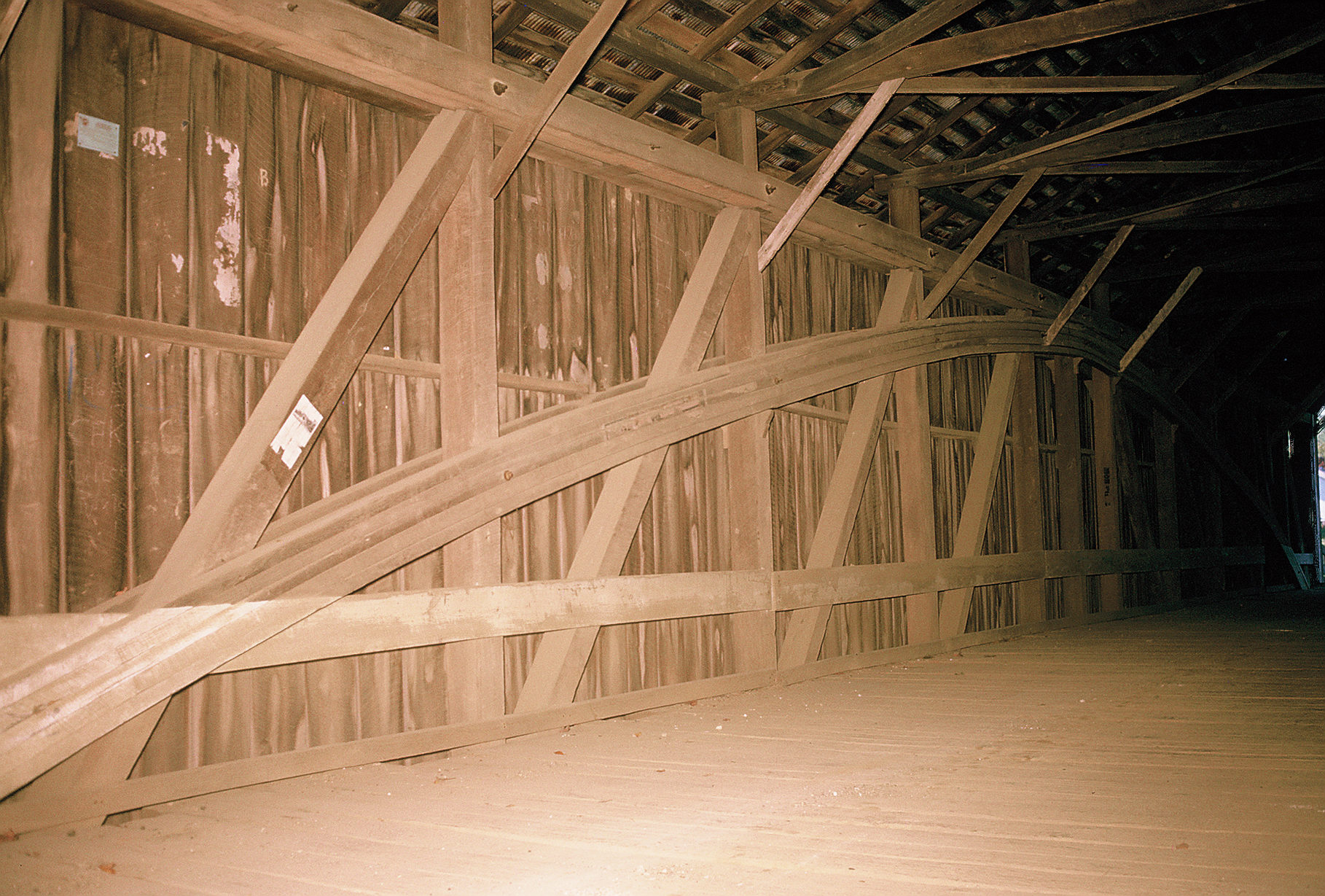
An interior view of the above bridge. |
 |
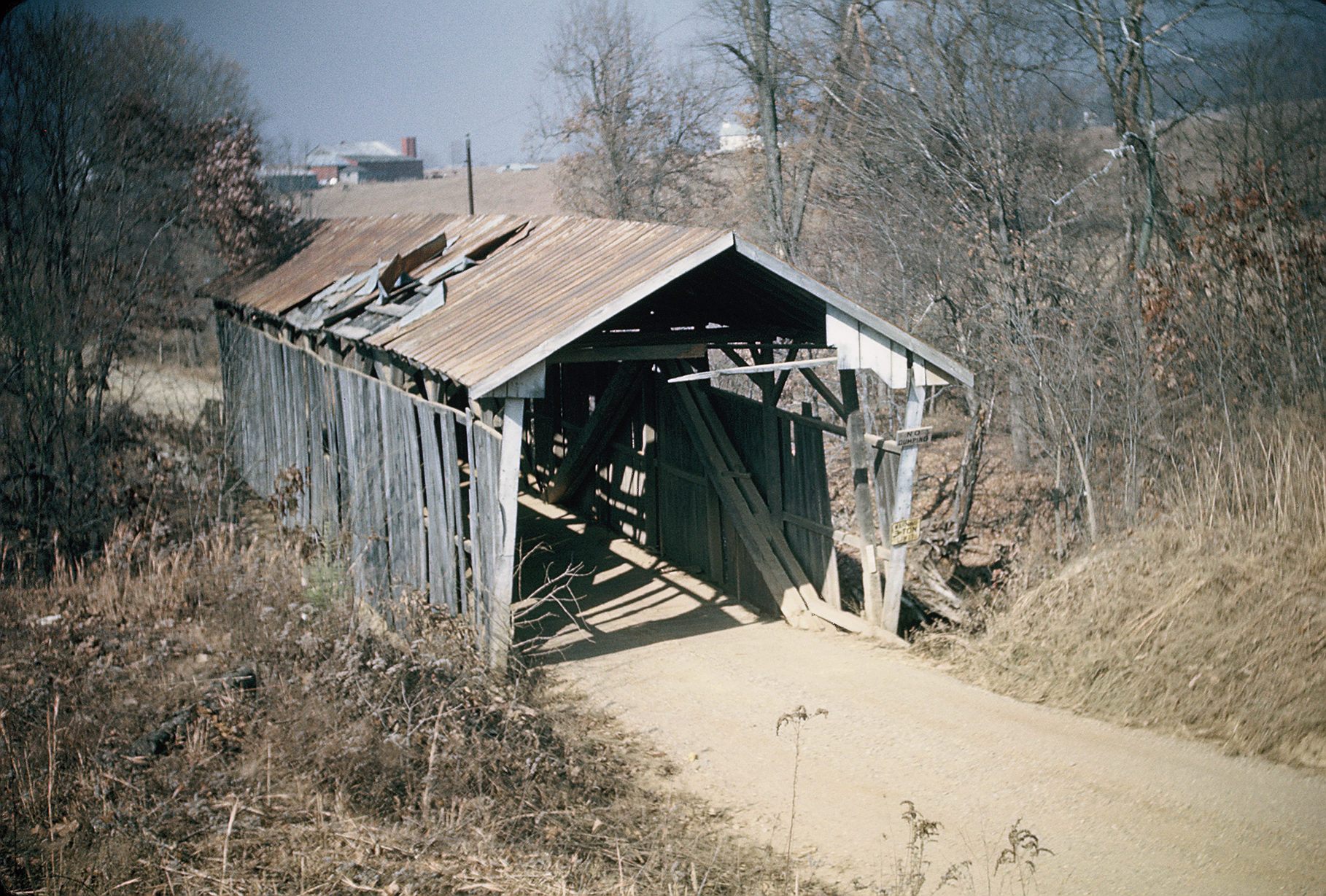
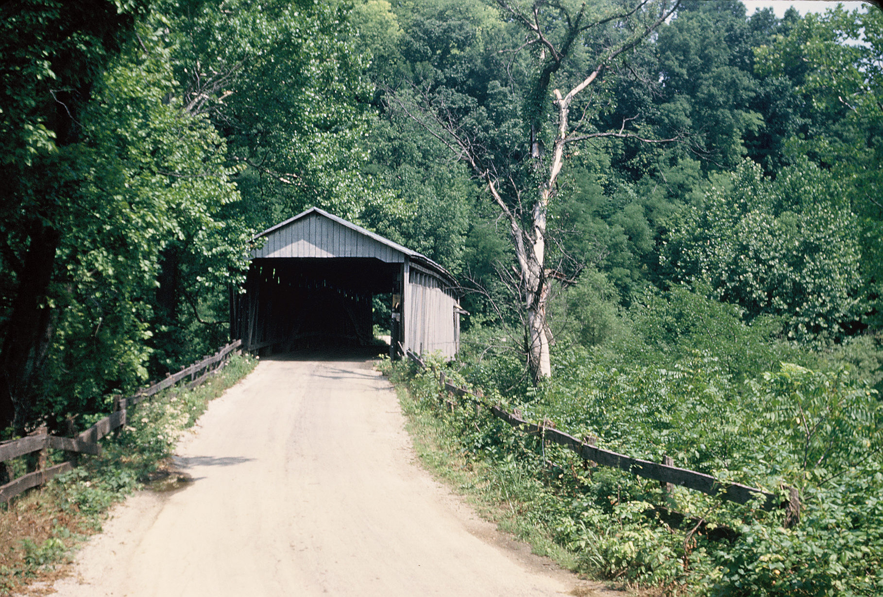
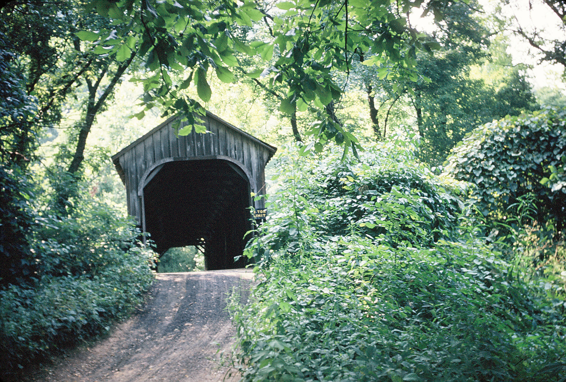
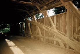
The "George Hutchins Bridge," located in Fairfield
County, Ohio. 60 feet in length. Photographed on August
8, 1953. Directions to the bridge were quite
obscure, but irrelevant at this point as
the bridge is no longer there. |
 |
The "Leonard Bridge," on a county road just south of
Basil, in Faiarfield County, Ohio. 96 feet in length,
photographed on August 9, 1953.
This bridge was removed in the late 1960's. |
 |
"Charles Loucks Bridge," over Walnut Creek on Township
Road #207 in Violet Township, Fairfield County. 139 feet
in length, with a date of 1901 carved into the bridge.
The bridge is now gone. |
 |
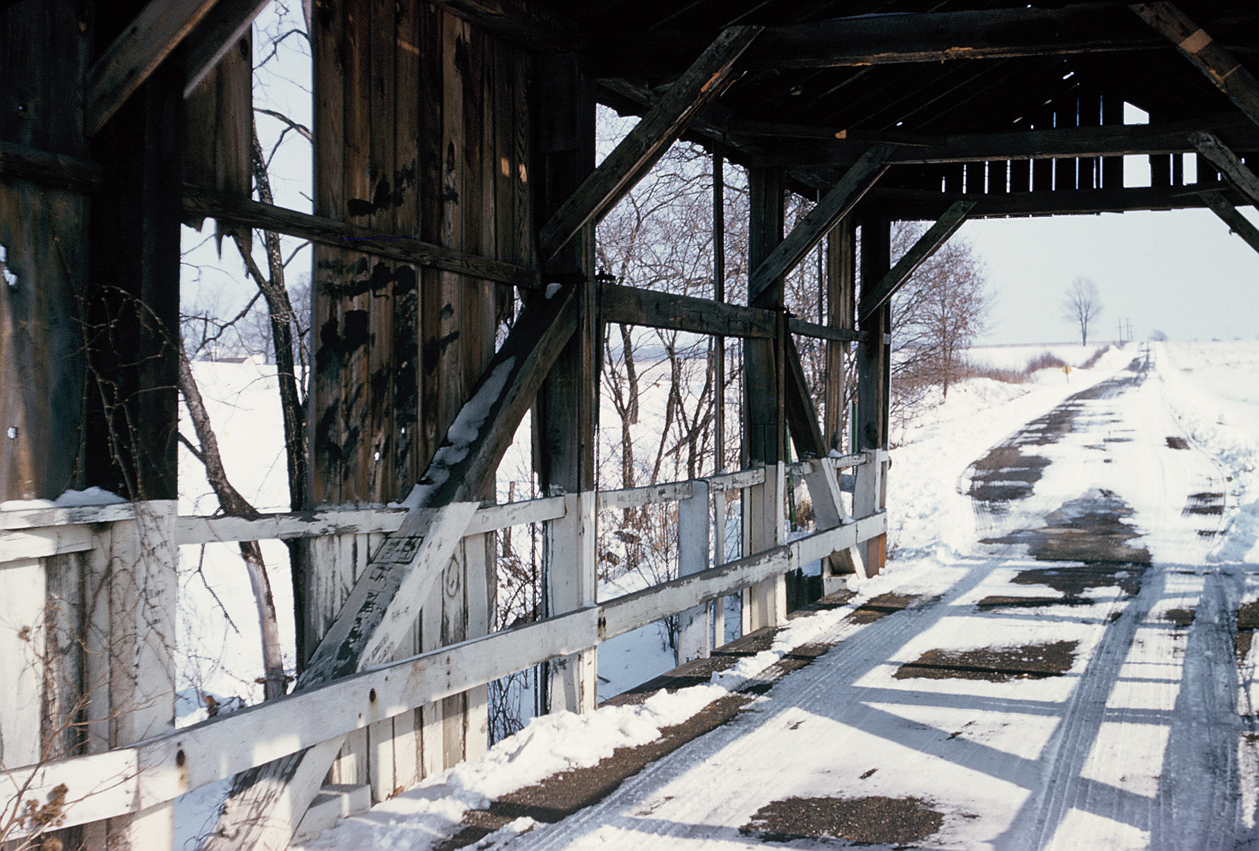
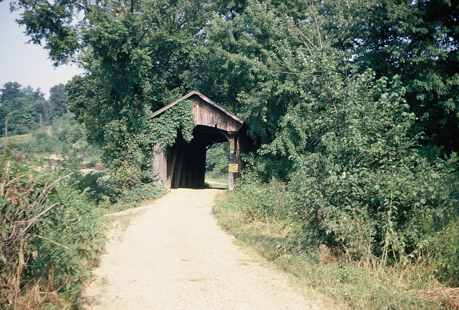
The "Johnson Bridge," located on a county road running
from Clearport to Camp Indianola, over Clear Creek.
"Howe Truss" style, 95 feet in length. Photographed
August 8, 1953. The bridge
remains in place but has been bypassed. |
 |
The "Mary Ruffner Bridge," located in Fairfield County,
Ohio on township Road 413 over Rush Creek. Smith Truss
design, with variations, 83 feet in length. Photographed
on August 8, 1959. Unsure if
the bridge remains in place. |
 |
A covered bridge in Fairfield County in Liberty Township
on Township Road 263, over Poplar Creek. Photographed on
August 8, 1959, the bridge was
moved to the Ohio University Lancaster Campus in 1988. |
 |
Another view of the bridge above. |
 |
The "Shayer Bridge,"over Walnut Creek on Township Road
232 in LIberty Township, Fairfield County, Ohio. 66 feet
in length, photographed on November 9, 1959.
The bridge has been moved to a
nearby farm. |
 |
The "Mink Hollow Bridge," located on Hocking Township
Road 293 in Fairfield County, Ohio, over Arney Run. 56
feet in length; photographed on July 16, 1960.
The bridge has been bypassed,
but remains in place. |
 |
A covered bridge over Sugar Creek on Waynesville Road
just south of Bellbrook in Greene County, Ohio.
Photographed on September 12, 1953, the bridge is 69
feet in length. Date carved into bridge is 1877.
The bridge is now gone. |
 |
A covered bridge on Hennville Road south/southeast of
Xenia, Ohio in Greene County. Burr truss with placed
posts showing influence from the Werning tradition. Two
dates carved in the bridge: 1894 and 1908. Photographed
October 3, 1953. 102 feet in length.
The bridge is now gone. |
 |
A covered bridge over Leatherwood Creek, 2 miles west of
Salesville on State Route 265. 47 feet long,
photographed on October 13, 1956. Salesville is the
locale of the events of the famed "Leatherwood God"
story by William Dean Howells, which was based on
real-live events. The bridge is
now gone. |
 |
A covered bridge at Beaver Mill Pond over Rocky Fork on
Statge Route 70 1 mile north of Carmal in Highland
County, Ohio. Photographed on September 19, 1953, the
bridge was 123 feet long. The
bridge is now gone. |
 |
A covered bridge in Licking County, Ohio over Moots Run,
2 miles south/southeast of Alexandria, Ohio.
Photographed on May 12, 1956. Fifty feet long.
The bridge is now gone. |
 |
A covered bridge in Licking County, Ohio on Liberty
Township Road 97 over Lobdell Creek, 2 miles
east/southeast of Johnstown, Ohio. Photographed May 13,
1956, the bridge is 54 feet in length.
The bridge is now gone. |
 |
The "Cain Archer Bridge," located in Noble County, Ohio
just west of State Route 260 about one and a half miles
west/northwest of Berne, over Duck Creek. Photographed
on May 24, 1958. 72 feet in length.
The bridge is now gone. |
 |
The "Upper Big Run Bridge," in Noble County, Ohio over
Big Run, 2 and a half miles southeast of Dungannon in
Jackson Township. Photographed May 31, 1953. Date carved
into bridge is 1911. 42 feet in length.
The bridge was in ruins by the
mid-1970s and is now gone. |
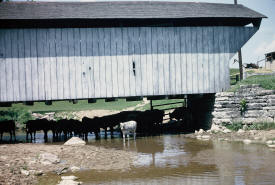 |
A covered bridge on Enterprise Road about a mile from
Ingomar, Preble County, Ohio. 54 feet in length;
photographed on May 30, 1953. Date carved in bridge is
January 1, 1897. The livestock are a nice touch!
The bridge is now gone. |
 |
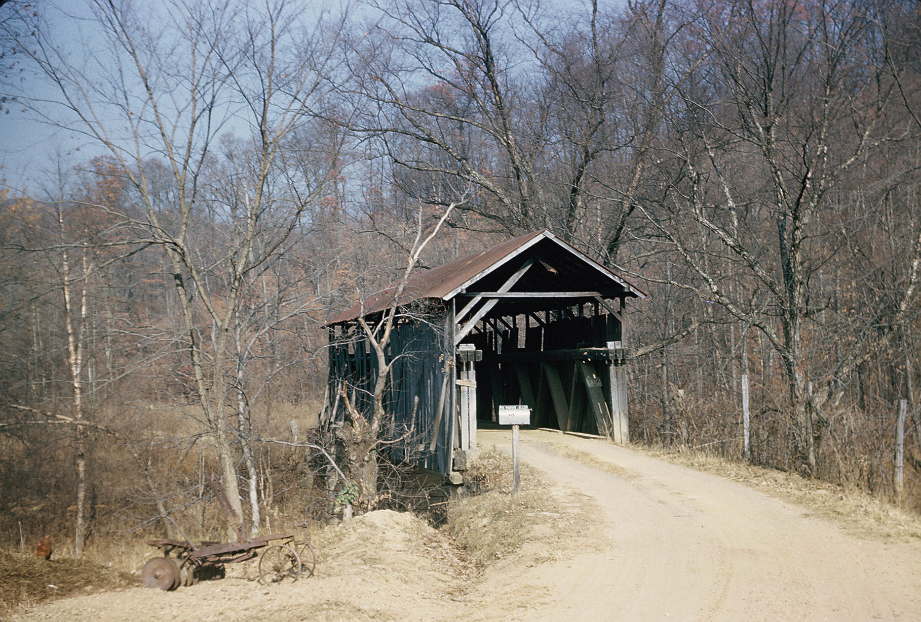
A covered bridge on Kendall Road in Scioto County, Ohio,
1 mile east of Minford over the Rocky Fork. Photographed
November 14, 1953; 81 feet in length.
Clearly in bad shape here, the
bridge is now gone. |
 |
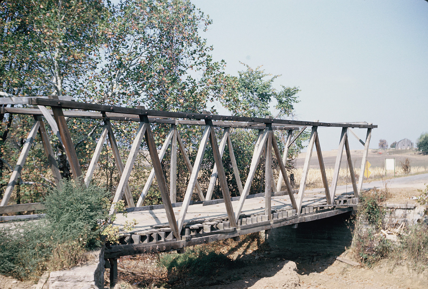
The "Shinn Bridge," west of Marietta, Ohio.
Travel west on Route 50A through Barlow; continue about
4-1/2 miles, make a right turn onto the bridge. Date
carved in the bridge is 1893. Photographed
September 21, 1963. Length not recorded. A Burr Truss,
but with laminated arch. The standard Burr Truss uses a
segmented arch, but many Ohio bridges featured the
laminated arch. The bridge is
still in place. |
 |
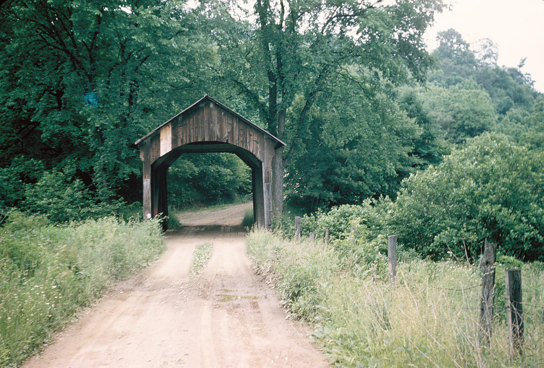
A covered bridge in Mahoning County, Ohio over Meander
Creek, 2 miles southeast of Ellsworth on Berlin Station
Road. 39 feet in length. Photographed on February 15,
1955. "Nice little queen post truss," notes Joseph D.
Conwill of the NSPCB. Dates carved are 1905-06.
The bridge no longer exists. |
 |
A covered bridge in Sandusky County, Ohio on County Road
9 over Wolf Creek, four miles east of Burgoon and three
miles south of Havens. Photographed November 8, 1954. A
Towne Truss design, 94 feet in length. Date carved into
bridge is September 2, 1881.
The bridge is still in place. |
 |
The "Helmic Bridge," also known as the "Island Run
Bridge," in Morgan County, Ohio on County Road 39 over
Island Run, 1-1/2 miles southwest of Eagleport. 72 feet
long. "A very nice site," notes Joseph D. Conwill of the
NSPCB. The bridge is still
there. |
 |
A covered bridge in Muskingum County, Ohio on Meigs
Township Road 221 over Brannon Creek, two miles
southeast of Young Hickory. Photographed March 23, 1957.
50 feet in length. The bridge
is now gone. |
 |
Another view of the bridge described above. |
 |
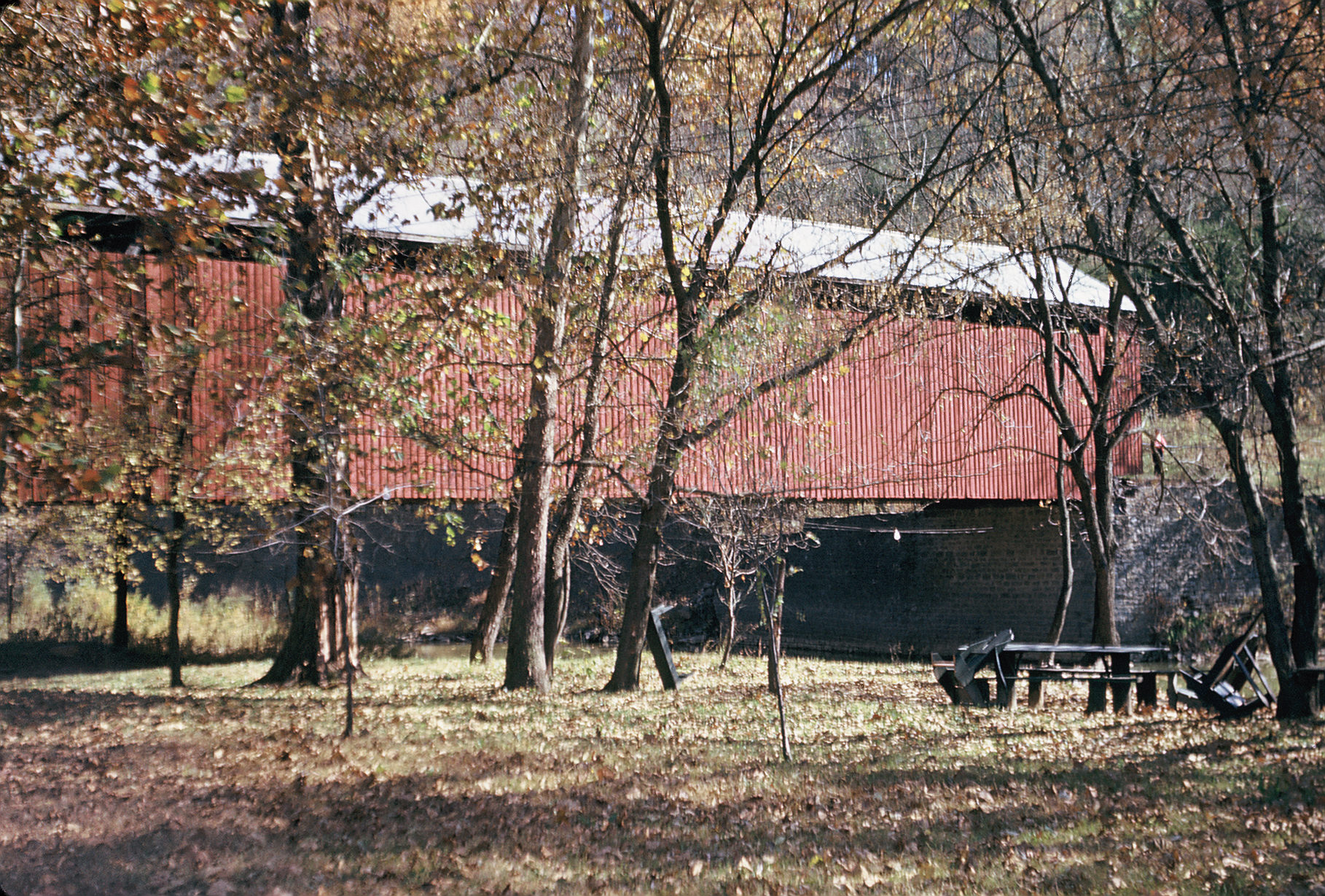
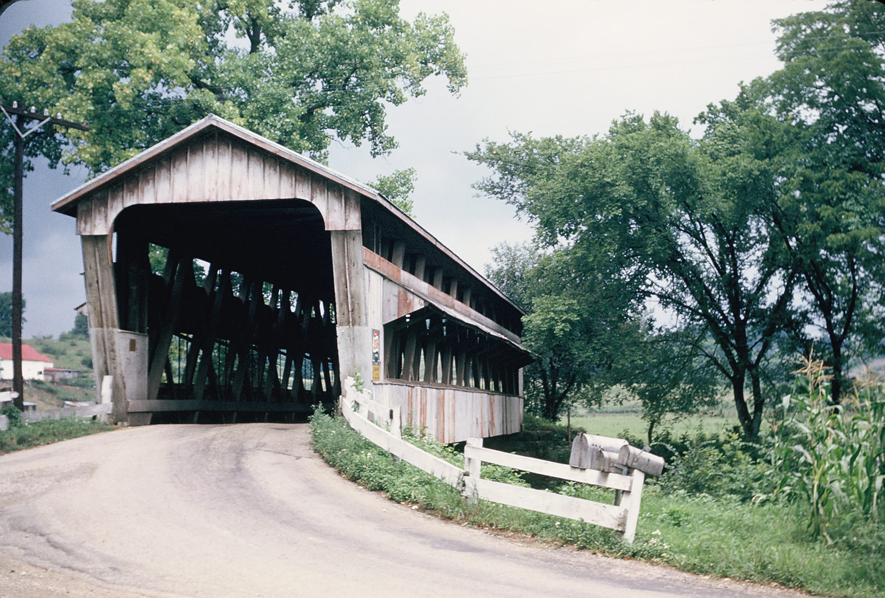
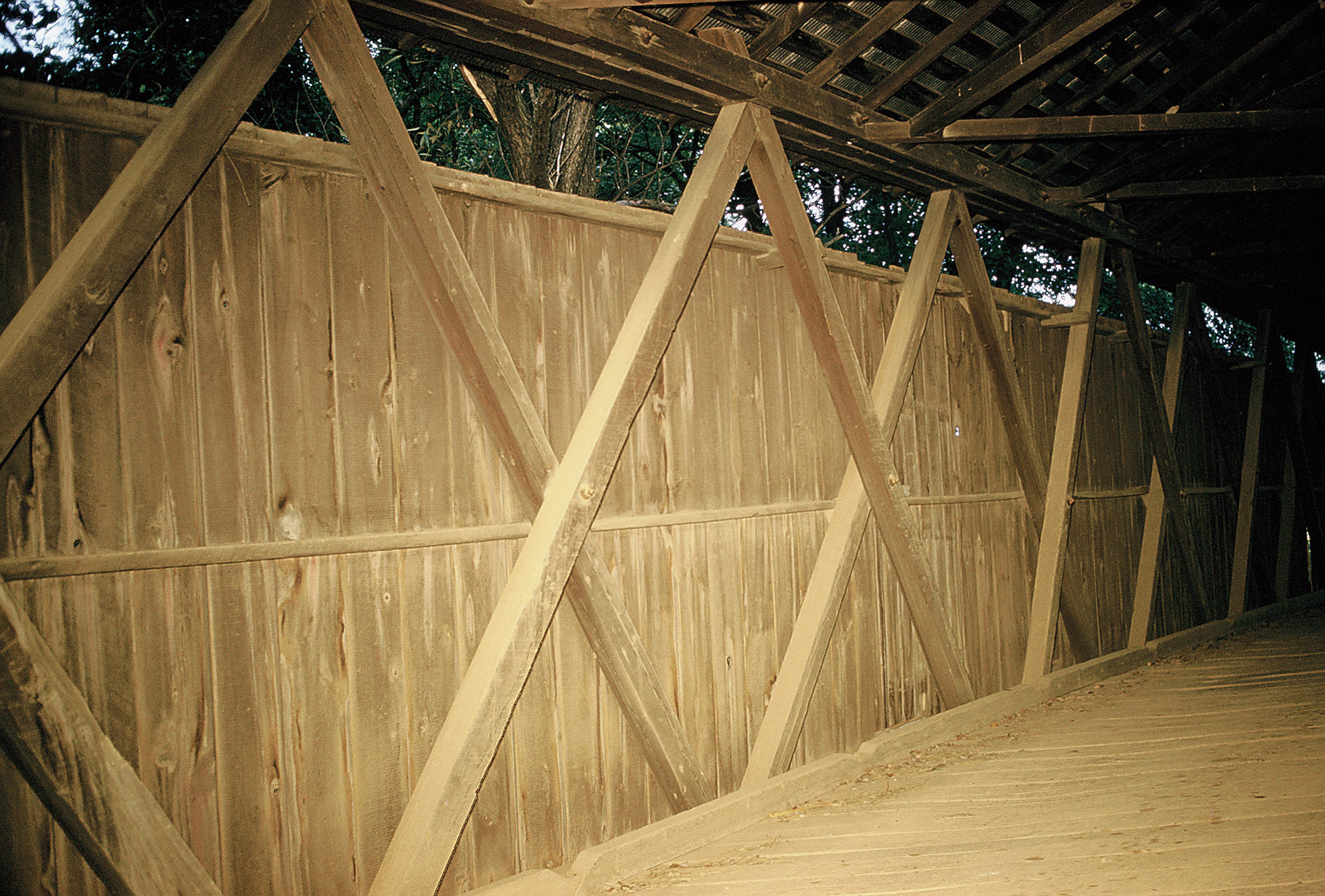
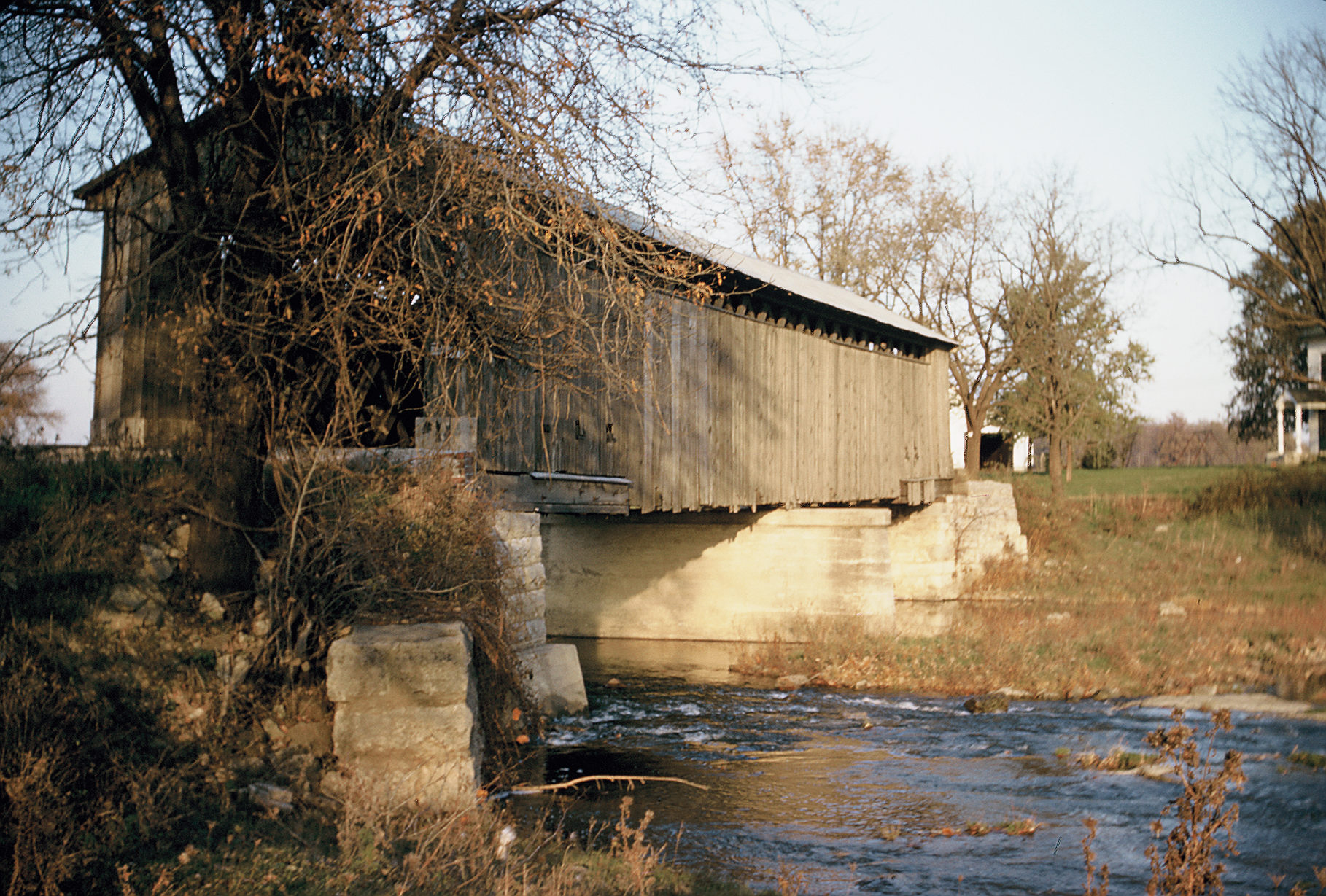
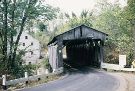
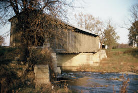
A covered bridge over Little Twin Creek on East Center
Street in Germantown, Montgomery County, Ohio. 99 feet
in length. Photographed August 29, 1953. The bridge
features unusual bowstring construction.
The bridge is still there. |
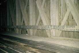 |
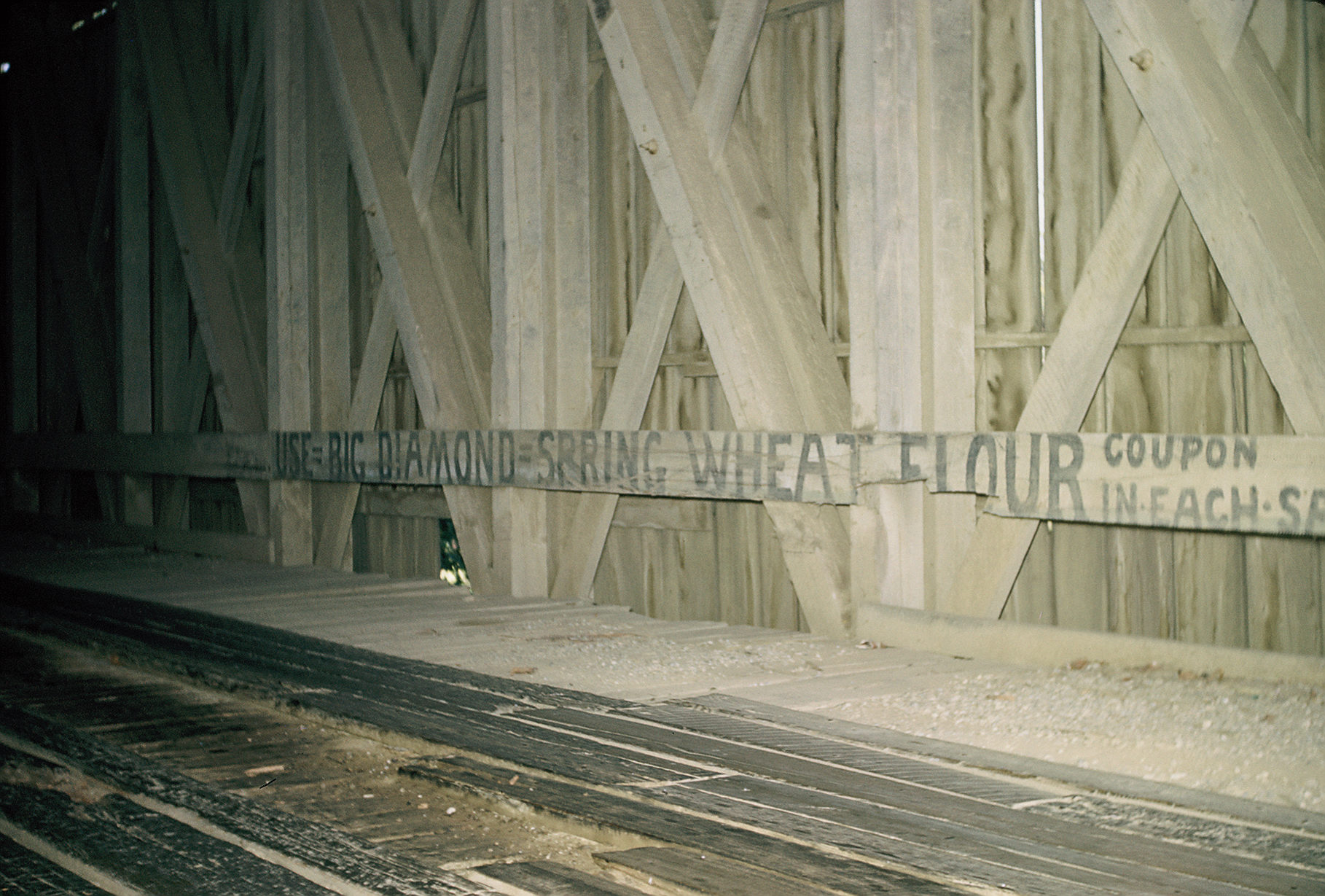
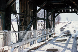
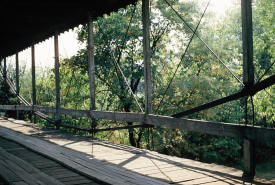
The interior of a covered bridge in Ross County, Ohio,
3.2 miles east of Bourneville just off U.S. 50 over
Paint Creek. Two spans, each 129 feet in length.
Photographed October 10, 1953. Date carved into
bridge is 1887. Note the old advertisements on the
inside panels! Features a long truss, patented in 1853.
The bridge is now gone. |
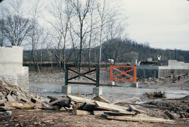 |
Out with the old, in with the new: A picture taken on
December 7, 1952 showing the construction work on a new
bridge on the site of a former covered bridge. |
 |
A covered bridge in Brown County, Ohio, 2.75 miles east
of Georgetown on State Route 125, then south 2.2 miles
over Straight Creek. 132 feet in length. Photographed
July 19, 1953. The bridge is
now gone. |
 |
The "Zeller-Smith" bridge in Fairfield County, Ohio over
Sycamore Creek about two miles south of Pickerington on
Township Road 216. Photographed on July 25, 1959.
The bridge was moved to a
nearby park in 1986. |
 |
A covered bridge - unusual for its flat roof - in
Fairfield County, Ohio 3.2 miles southeast of Bremen on
State Route 312 over Rush Creek. Constructed in 1918 -
possibly the newest covered bridge in the state, though
another one may have been built in 1919, making this the
second-newest. All oak construction, 117 feet in length.
Photographed August 8, 1953.
The bridge is now gone. |
 |
The "Swartz Mill" Bridge in Fairfield County, Ohio on
Township Road 294 over the Rush Creek. 102 feet in
length. Photographed on August 8, 1959.
The bridge is now gone. |
 |
The "Roley School" Bridge, a beautifully rendered
covered bridge over Walnut Creek on Towhship Road 240 in
Liberty Township, Fairfield County, Ohio. 48 feet in
length. Moved to the county
fairgrounds in 1972. |
 |
The "McLeery" Bridge in Liberty Township over
Walnut Creek on Township Road 238. 96 feet in length.
Photographed November 9, 1959.
The bridge was moved to a nearby farm, though
considerably shortened in length. |
 |
A formerly covered bridge, Warren Truss style, in Greene
County, Ohio on Hoop Road, half mile north of
Waynesville, over Caesar's Creek. 68 feet in length.
Photographed October 3, 1953.
The bridge is now gone. |
 |
A covered bridge in a lovely setting in Guernsey County,
Ohio on Township Road 209off County Road 8 south out of
Kimbolton. Two spans over Wills Creek, 84 and 42 feet in
length. Date carved is 1900. Photographed August 1,
1953. The bridge is now gone. |
 |
A covered bridge in Guernsey County, Ohio 3 miles south
of Salem on State Route 21. Date carved is 1909.
Photographed August 1, 1953.
The bridge is now gone. |
 |
A covered bridge in Guernsey County, Ohio just east of
State Route 271, 2-1/2 mils southeast of North Salem. 48
feet in length. Photographed on August 1, 1953.
The bridge is now gone. |
 |
A covered bridge in Guernsey County, Ohio over Sugartree
Fork 2-1/2 miles east/southeast of Birmingham in
Washington Township. 39 feet in length. Photographed
October 13, 1956. All wood dowelled.
The bridge is now gone. |
 |
A covered bridge in Monroe County, Ohio over Wills
Creek, just west of State Route 78 and just south of
Burkhart. 36 feet in length. Photographed May 31, 1958.
The bridge is now gone. |
 |
The "Parrish" Bridge in Noble County, Ohio on Noble
County Road #8 south from Sharon 2.7 miles. 78 feet in
length, photographed on November 2, 1957.
The bridge remains in place,
though it has since been bypassed. |
 |
The "Manchester" Bridge in Noble County, Ohio. Take
Sharon Township Road #3 south from State Route 78 at
Olive Green for 2.1. miles. Turn west 200 feet. The
bridge, 48 feet in length, runs over Olive Green Creek.
Portal dated 1915. The bridge
is still there, though it has been bypassed, and the
area has been strip-mined. |
 |
A covered bridge in Noble County, Ohio over Beaver Creak
on State Route 147 about 1-1/2 miles west of Batesville.
48 feet in length. Photographed on November 3, 1957.
Dates carved range from 1891 to 1907.
The bridge is now gone. |
 |
The "Dixon Branch" Bridge, in Preble County, OHio on
Concord Road just west of Wyatt Road, about 5 and a half
miles northeast of Fairhaven. Date carved is 1909.
Length is 56 feet. The bridge
was moved to a nearby park. |
 |
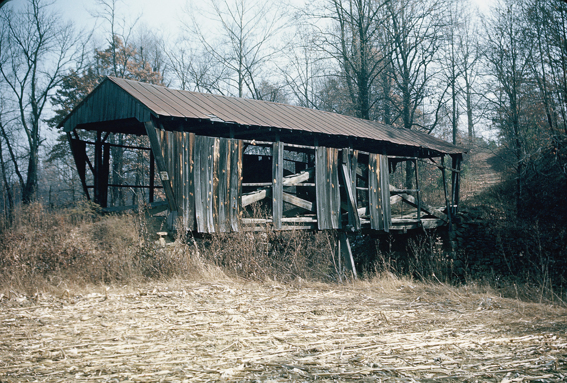
A tattered but lovely covered bridge in Scioto County,
Ohio. 54 feet in length, deep in the countryside 1/2
mile south of Minford on State Route 335, over Long Run.
Photographed on November 14, 1953.
The bridge is now gone. |
 |
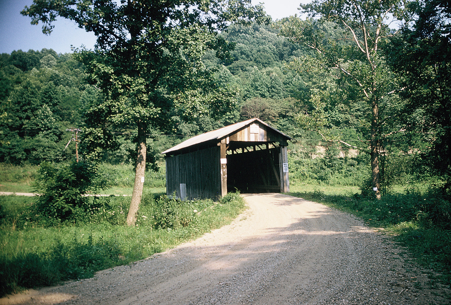
A covered bridge in Scioto County, Ohio over Long Run on
County Road 222, 3 miles east of Minford. Length was not
noted in Traugott Keller's notes. Photographed on
November 14, 1953. The bridge
is now gone. |
 |
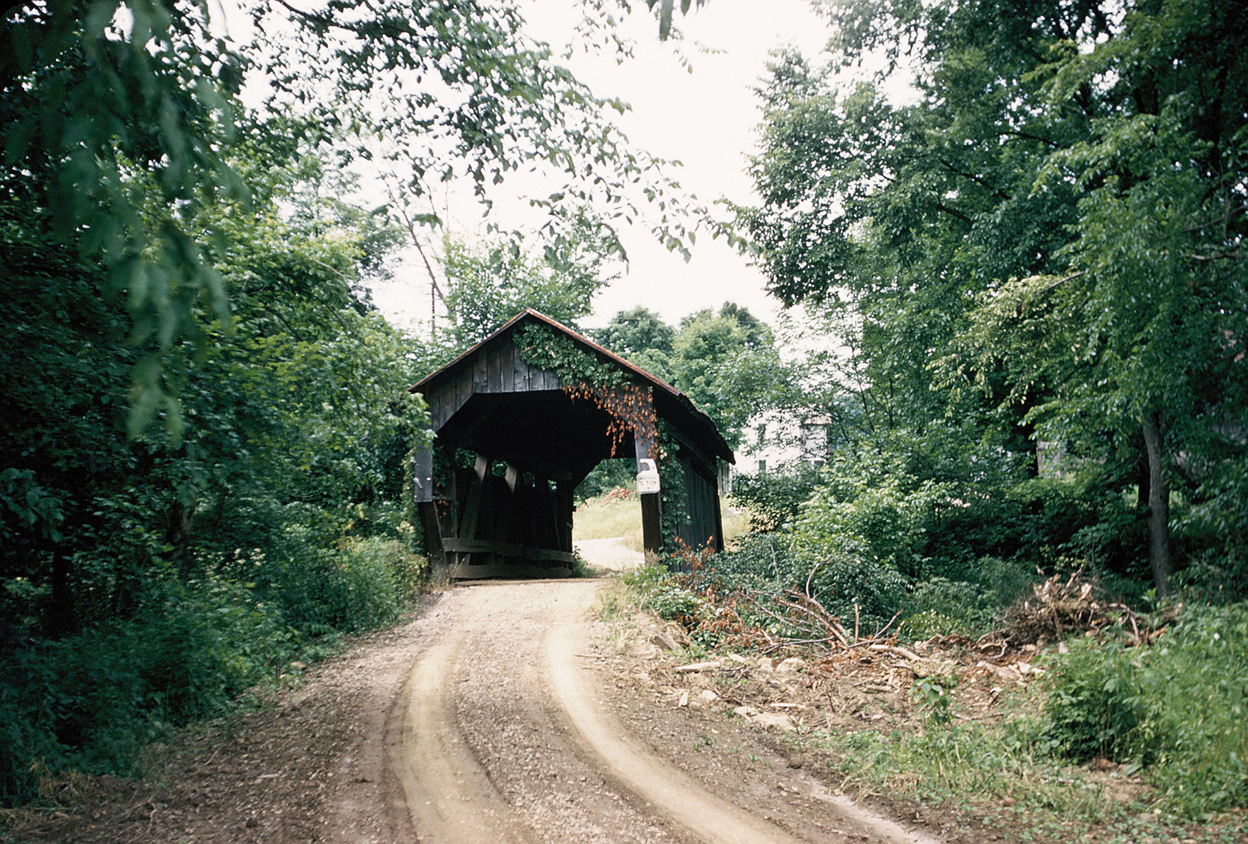
A covered bridge in Washington County, Ohio over Leith's
Run just off County Road 9 in Grandview Township. 45
feet in length. Photographed on July 30, 1960.
The bridge is now gone. |
 |
A covered bridge in Harrison County, Ohio over Laurel
Creek 2-1/2 miles northwest of Tippecanoe just east of
State Route 258. Photographed on July 3, 1955. 48 feet
in length. All mortised and dowelled.
The bridge is now gone. |
 |
A covered bridge on Amity Pike just east of Amity in
Madison County, Ohio, over Big Darby Creek. Date carved
is 1908. 216 feet in length over two spans. Photographed
on February 8, 1953. The bridge
is now gone. |